Trego County
| Trego County | |
| County | |
| Land |  USA USA |
|---|---|
| Delstat |  Kansas Kansas |
| Huvudort | WaKeeney |
| Största stad | WaKeeney |
| Area | 2 330 km² (2010)[1] |
| - land | 2 304 km² (99%) |
| - vatten | 26,3 km² (1%) |
| Folkmängd | 3 001 (2010)[2] |
| Befolkningstäthet | 1,3 invånare/km² |
| Grundat | 21 juni 1879 |
| - uppkallat efter | Edward P. Trego |
| Tidszon | CST (UTC-6) |
| - sommartid | CDT (UTC-5) |
| FIPS-kod | 20195 |
| Geonames | 4280609 |
 Läge i delstaten Kansas. | |
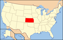 Delstatens läge i USA. | |
| Webbplats: http://www.tregocountyks.com | |
| Fotnoter: Naco - Find a county | |
Trego County är ett administrativt område i delstaten Kansas, USA. År 2010 hade countyt 3 001 invånare. Den administrativa huvudorten (county seat) är WaKeeney.
Geografi
Enligt United States Census Bureau har countyt en total area på 2 328 km². 2 301 km² av den arean är land och 28 km² är vatten.
Angränsande countyn
[3]
- Graham County - norr
- Rooks County - nordost
- Ellis County - öst
- Ness County - söder
- Gove County - väst
Större vägar
[3]
- Interstate 70
- U.S. Route 40
- U.S. Route 283
- K-147
Kommuner
Trego County är uppdelat i sju kommuner (townships). Ingen av townships har styre över de andra.[4] Det finns två städer, Collyer som ingår i Collyer Township och WaKeeney som ingår i WaKeeney Township.
| Kommun | Befolkning | Befolkningstäthet /km² (/sq mi) | Landyta km² (sq mi) | Vattenyta km² (sq mi) | Andel vatten | Geografiska koordinater |
|---|---|---|---|---|---|---|
| Collyer | 368 | 1 (2) | 517 (200) | 0 (0) | 0,02% | 39°0′31″N 100°3′55″W |
| Franklin | 60 | 0 (1) | 259 (100) | 0 (0) | 0% | 38°45′42″N 100°4′10″W |
| Glencoe | 70 | 1 (2) | 93 (36) | 0 (0) | 0% | 38°55′40″N 99°38′30″W |
| Ogallah | 214 | 1 (1) | 373 (144) | 0 (0) | 0,05% | 39°0′31″N 99°41′49″W |
| Riverside | 117 | 0 (1) | 296 (114) | 15 (6) | 4,95% | 38°47′32″N 99°42′41″W |
| WaKeeney | 2 398 | 5 (13) | 465 (179) | 0 (0) | 0,03% | 39°0′41″N 99°52′36″W |
| Wilcox | 92 | 0 (1) | 298 (115) | 12 (5) | 3,85% | 38°47′25″N 99°52′37″W |
Källor
- ^ ”2010 Census U.S. Gazetteer Files for Counties”. U.S. Census Bureau. Arkiverad från originalet den 5 juli 2012. https://www.webcitation.org/68vYLbou5?url=http://www.census.gov/geo/www/gazetteer/files/Gaz_counties_national.txt. Läst 5 juli 2012.
- ^ ”State & County QuickFacts, Trego County, Kansas” (på engelska). U.S. Census Bureau. Arkiverad från originalet den 21 juli 2011. https://www.webcitation.org/60LAcIUyP?url=http://quickfacts.census.gov/qfd/states/20/20195.html. Läst 6 juli 2011.
- ^ [a b] ”County Maps - Trego County”. www.tregocountyks.com. Arkiverad från originalet den 13 januari 2016. https://web.archive.org/web/20160113200341/http://www.tregocountyks.com/map. Läst 25 februari 2016.
- ^ ”Trego County QuickFacts from the US Census Bureau”. quickfacts.census.gov. Arkiverad från originalet den 5 september 2015. https://web.archive.org/web/20150905061105/http://quickfacts.census.gov/qfd/states/20/20195.html. Läst 25 februari 2016.
Bilder & media

|


