South Yarmouth

Questa voce sull'argomento centri abitati del Massachusetts è solo un abbozzo.
Contribuisci a migliorarla secondo le convenzioni di Wikipedia.
| South Yarmouth CDP | |
|---|---|
| (EN) South Yarmouth, Massachusetts | |
 | |
| Localizzazione | |
| Stato |  Stati Uniti Stati Uniti |
| Stato federato |  Massachusetts Massachusetts |
| Contea | Barnstable |
| Territorio | |
| Coordinate | 41°40′04.08″N 70°11′58.92″W41°40′04.08″N, 70°11′58.92″W (South Yarmouth) |
| Altitudine | 6 m s.l.m. |
| Superficie | 20,23 km² |
| Abitanti | 11 092 (2010) |
| Densità | 548,33 ab./km² |
| Altre informazioni | |
| Cod. postale | 02664 |
| Fuso orario | UTC-5 |
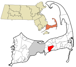
| Cartografia | |
  South Yarmouth | |
 | |
| Modifica dati su Wikidata · Manuale | |
South Yarmouth è un census-designated place (CDP) degli Stati Uniti d'America, situato nello stato del Massachusetts, nella contea di Barnstable.
Altri progetti
Altri progetti
- Wikimedia Commons
 Wikimedia Commons contiene immagini o altri file su South Yarmouth
Collegamenti esterni
- (EN) South Yarmouth (census-designated place) / South Yarmouth (insediamento umano), su Geographic Names Information System, USGS.


V · D · M | |
|---|---|
| Città | Barnstable (capoluogo) |
| Town | Bourne · Brewster · Chatham · Dennis · Eastham · Falmouth · Harwich · Mashpee · Orleans · Provincetown · Sandwich · Truro · Wellfleet · Yarmouth |
| CDP | Bourne · Brewster · Buzzards Bay · Chatham · Dennis · Dennis Port · East Dennis · East Falmouth · East Harwich · East Sandwich · Falmouth · Forestdale · Harwich Center · Harwich Port · Mashpee Neck · Monomoscoy Island · Monument Beach · New Seabury · North Eastham · North Falmouth · Northwest Harwich · Orleans · Pocasset · Popponesset Island · Popponesset · Provincetown · Sagamore · Sandwich · Seabrook · Seconsett Island · South Dennis · South Yarmouth · Teaticket · West Chatham · West Dennis · West Falmouth · West Yarmouth · Woods Hole · Yarmouth Port |
| Villaggi | Barnstable Village · Centerville · Cotuit · Craigville · Hatchville · Hyannis · Long Point · Marstons Mills · Menauhant · North Harwich · North Truro · Osterville · Pleasant Lake · Sagamore Beach · South Harwich · West Barnstable · West Harwich |
 Portale Stati Uniti d'America: accedi alle voci di Wikipedia che parlano degli Stati Uniti d'America


