Woodlands, Manitoba
Place in Manitoba, Canada
50°12′26″N 97°39′36″W / 50.20722°N 97.66000°W / 50.20722; -97.66000 Canada
 Manitoba
R0C 3H0
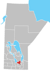
Woodlands is an unincorporated community in the Rural Municipality of Woodlands in the Interlake Region of Manitoba, Canada. It is located approximately 40 kilometres (25 miles) north-west of Winnipeg.
Woodlands was named by D. Porteus, for the surrounding lands to the north, west and east which are wooded. The post office was established in 1874.[1]
Environment Canada's weather radar station that serves the Winnipeg area is located in Woodlands.[2] Woodlands is also home to the Woodlands Pioneer Museum.[3]
References
- ^ Geographical Names of Manitoba (PDF). Winnipeg, Manitoba: Manitoba Conservation. 2000.
- ^ Canada, Environment (April 16, 2013). "Weather Radar - Woodlands, MB - Environment Canada". weather.gc.ca. Retrieved December 30, 2020.
- ^ "Historic Sites of Manitoba: Woodlands Pioneer Museum (Woodlands, RM of Woodlands)". www.mhs.mb.ca. Retrieved December 30, 2020.
External links
- Weather Radar - Woodlands, Manitoba
- v
- t
- e
Division No. 14, Manitoba (South Interlake)
- Argyle
- Balmoral
- Erinview
- Grosse Isle (part)
- Gunton
- Komarno
- Lake Francis
- Marquette
- Reaburn
- Stony Mountain
- Warren
- Woodlands
 | This Manitoba location article is a stub. You can help Wikipedia by expanding it. |
- v
- t
- e


