Uftrungen
German village
Ortsteil of Südharz in Saxony-Anhalt, Germany
Location of Uftrungen

51°29′56″N 10°58′47″E / 51.49889°N 10.97972°E / 51.49889; 10.97972
(2006-12-31)
06548
Uftrungen is a village and a former municipality in the Mansfeld-Südharz district, Saxony-Anhalt, Germany. Since 1 January 2010, it is part of the municipality Südharz.
-
 The Schluftstraße
 -
 Village centre with church
 -
 Abandoned area "An der Kirche"
 -
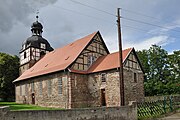 St. Andrews' church (1732–1734)


Authority control databases | |
|---|---|
| International |
|
| National |
|
- v
- t
- e


