USA-192
American navigation satellite used for GPS
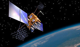 A Block IIRM GPS satellite | |
| Mission type | Navigation |
|---|---|
| Operator | US Air Force |
| COSPAR ID | 2006-052A[1] |
| SATCAT no. | 29601[1] |
| Mission duration | 10 years (planned)[2] |
| Spacecraft properties | |
| Spacecraft type | GPS Block IIRM[2] |
| Bus | AS-4000[2] |
| Manufacturer | Lockheed Martin[2] |
| Launch mass | 2,032 kilograms (4,480 lb)[2] |
| Start of mission | |
| Launch date | 17 November 2006, 19:12:00 (2006-11-17UTC19:12Z) UTC |
| Rocket | Delta II 7925-9.5, D321[3] |
| Launch site | Cape Canaveral SLC-17A[3] |
| Orbital parameters | |
| Reference system | Geocentric |
| Regime | Medium Earth (Semi-synchronous) |
| Perigee altitude | 20,087 kilometers (12,481 mi)[4] |
| Apogee altitude | 20,277 kilometers (12,600 mi)[4] |
| Inclination | 55 degrees[4] |
| Period | 717.96 minutes[4] |
USA-192, also known as GPS IIR-16(M), GPS IIRM-3 and GPS SVN-58, is an American navigation satellite which forms part of the Global Positioning System. It was the third of eight Block IIRM satellites to be launched, and the sixteenth of twenty one Block IIR satellites overall. It was built by Lockheed Martin, using the AS-4000 satellite bus.[2]
USA-192 was launched at 19:12:00 UTC on 17 November 2006, atop a Delta II carrier rocket, flight number D321, flying in the 7925-9.5 configuration.[3] The launch took place from Space Launch Complex 17A at the Cape Canaveral Air Force Station,[5] and placed USA-192 into a transfer orbit. The satellite raised itself into medium Earth orbit using a Star-37FM apogee motor.[2]
By 17 January 2007, USA-192 was in an orbit with a perigee of 20,087 kilometers (12,481 mi), an apogee of 20,277 kilometers (12,600 mi), a period of 717.96 minutes, and 55 degrees of inclination to the equator.[4] It is used to broadcast the PRN 12 signal, and operates in slot 4 of plane B of the GPS constellation. The satellite has a mass of 2,032 kilograms (4,480 lb), and a design life of 10 years.[2] As of 2019 it remains in service.
References
- ^ a b "Navstar 59". US National Space Science Data Center. Retrieved 11 July 2012.
- ^ a b c d e f g h Krebs, Gunter. "GPS-2RM (Navstar-2RM)". Gunter's Space Page. Retrieved 11 July 2012.
- ^ a b c McDowell, Jonathan. "Launch Log". Jonathan's Space Page. Retrieved 11 July 2012.
- ^ a b c d e McDowell, Jonathan. "Satellite Catalog". Jonathan's Space Page. Retrieved 11 July 2012.
- ^ McDowell, Jonathan. "Launch List". Launch Vehicle Database. Jonathan's Space Page. Retrieved 11 July 2012.
 Spaceflight portal

- v
- t
- e
NAVSTAR Global Positioning System satellites
- 01
- 02
- 03
- 04
- 05
- 06
- 07
- 08
- 09
- 10
- 11
- 12
- 13
- 14
- 15
- 16
- 17
- 18
- 19
- 20
- 21
- 22
Italics indicate future missions. Signs † indicate launch failures.
 | This article about one or more spacecraft of the United States is a stub. You can help Wikipedia by expanding it. |
- v
- t
- e


