Tobi (island)
Island in the Republic of Palau

Tobi
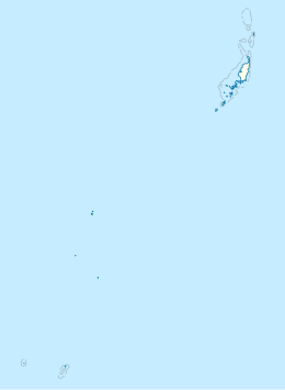
Location of Tobi in Palau
Palau
Tobi is an island in the Palauan state of Hatohobei.[1] Tobi Island is 1.6 km long and 0.8 km wide, and has an area of about 0.85 square kilometres (0.33 sq mi). With a population of 39 according to a 2020 census[2], it holds all of the state's people, with the exception of a weather base on Helen Island. Most of the inhabitants live on the island's west side and speak Tobian.
Tobi, Helen Reef (Hotsarihie), Transit Reef (Pieraurou), and the islands in the state of Sonsorol make up the Republic of Palau's Southwest Islands.
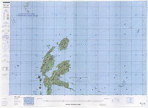
Map including Pulau Tobi and Helen Reef on the upper right (DMA, 1977)

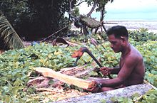
Tobi Island Bai
Climate
Tobi Island has a tropical rainforest climate (Af) with heavy to very heavy rainfall year-round. The Joint Typhoon Warning Center (JTWC) a United States Navy – United States Air Force command in Hawaii uses "KOBI" as a bearing and distance in determining a tropical storm's track and position.
| Climate data for Tobi Island | |||||||||||||
|---|---|---|---|---|---|---|---|---|---|---|---|---|---|
| Month | Jan | Feb | Mar | Apr | May | Jun | Jul | Aug | Sep | Oct | Nov | Dec | Year |
| Mean daily maximum °C (°F) | 29.0 (84.2) | 28.0 (82.4) | 29.0 (84.2) | 29.0 (84.2) | 29.0 (84.2) | 29.0 (84.2) | 29.0 (84.2) | 29.0 (84.2) | 29.0 (84.2) | 29.0 (84.2) | 29.0 (84.2) | 29.0 (84.2) | 28.9 (84.1) |
| Mean daily minimum °C (°F) | 25.0 (77.0) | 25.0 (77.0) | 25.0 (77.0) | 26.0 (78.8) | 26.0 (78.8) | 26.0 (78.8) | 26.0 (78.8) | 26.0 (78.8) | 26.0 (78.8) | 26.0 (78.8) | 26.0 (78.8) | 26.0 (78.8) | 25.8 (78.3) |
| Average precipitation mm (inches) | 286 (11.3) | 256 (10.1) | 295 (11.6) | 251 (9.9) | 361 (14.2) | 438 (17.2) | 387 (15.2) | 307 (12.1) | 249 (9.8) | 242 (9.5) | 302 (11.9) | 310 (12.2) | 3,684 (145) |
| Source: Meteoblue.com[3] | |||||||||||||
References
Wikimedia Commons has media related to Tobi Island.
- ^ "Basic Information about Tobi: A brief overview of the Tobi community". www.friendsoftobi.org. Retrieved 17 January 2022.
- ^ "Census of Population and Housing" (PDF). August 2022. p. 10. Retrieved 14 June 2024.
{{cite web}}: CS1 maint: url-status (link) - ^ "Climate: Tobi Island". Meteoblue.com. Retrieved July 30, 2020.
03°00′22″N 131°07′26″E / 3.00611°N 131.12389°E / 3.00611; 131.12389
- v
- t
- e
 | This article about an island is a stub. You can help Wikipedia by expanding it. |
- v
- t
- e


