Sunnymead
Human settlement in England
- unparished
- Oxford
- Oxfordshire
- South East
- Oxford West and Abingdon
- List of places
- UK
- England
- Oxfordshire
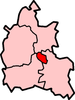
Sunnymead is a suburb in the northern part of Oxford, England, just south of the Oxford Ring Road (A40). Close by are the suburbs of Cutteslowe to the north, Summertown to the south and Upper Wolvercote to the west. To the east is the River Cherwell, which flows south towards central Oxford.
See also
- v
- t
- e
The City of Oxford
- Oxfordshire
- County Council elections
- City Council elections
- Oxford East Borough Constituency
- Oxford West and Abingdon County Constituency
neighbourhoods
and districts
- Barton
- Binsey
- Cowley
- Cutteslowe
- Donnington
- Godstow
- Grandpont
- Headington
- Holywell
- Iffley
- Jericho
- New Botley
- New Hinksey
- New Marston
- Norham Manor
- North Oxford
- Northway
- Osney
- Port Meadow
- St Clement's
- St. Ebbes
- St John Street area
- St. Thomas'
- Science Area
- Summertown
- Sunnymead
- Walton Manor
- Wolvercote
- Waterways
and borough
constituencies
- Oxford Borough Constituency
- Oxfordshire County Constituency
- Oxford University Constituency
 | This Oxfordshire location article is a stub. You can help Wikipedia by expanding it. |
- v
- t
- e


