St. Mullin's Upper
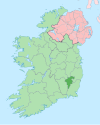
Barony in County Carlow, Ireland
Barony in Leinster, Ireland
St. Mullin's Upper Tigh Moling Uachtarach (Irish) | |
|---|---|
Barony | |
 | |
| Country | Ireland |
| Province | Leinster |
| County | Carlow |
| Area | |
| • Land | 32 km2 (12 sq mi) |
St. Mullin's Upper (Irish: Tigh Moling Uachtarach) is a barony in County Carlow, Ireland.
Etymology
The original St. Mullin's barony took its name from the village of St. Mullin's (Irish: Tigh Moling).[1] The area now called St. Mullin's Upper was formerly an exclave until the two parts were separated in 1841.
Location
St. Mullin's Upper is found in east County Carlow, east of the River Slaney and west of the River Derry. It does not border St. Mullin's Lower.
St. Mullin's Upper is bordered to the west by Forth, County Carlow; to the east and north by Shillelagh, County Wicklow; and to the south by Scarawalsh, County Wexford.
History
Very early this area was referred to as Fearann Uí Néill, or the country of Farren O'Neale, lords of Tully. This may refer to the Uí Néill sept of Magh Dá Chonn in Leinster.[2]
List of settlements
Below is a list of settlements in St. Mullin's Upper:
References
- v
- t
- e
Places in County Carlow
townlands
- Carlow
- Forth
- Idrone East
- Idrone West
- Rathvilly
- St. Mullin's Lower
- St. Mullin's Upper
- List of townlands in County Carlow
- Category: Mountains and hills of County Carlow
- Category: Rivers of County Carlow
- Category: Geography of County Carlow
 | This article related to the geography of County Carlow, Ireland is a stub. You can help Wikipedia by expanding it. |
- v
- t
- e


