Shush, Iran
City in Khuzestan province, Iran
You can help expand this article with text translated from the corresponding article in Persian. (September 2020) Click [show] for important translation instructions.
- View a machine-translated version of the Persian article.
- Machine translation, like DeepL or Google Translate, is a useful starting point for translations, but translators must revise errors as necessary and confirm that the translation is accurate, rather than simply copy-pasting machine-translated text into the English Wikipedia.
- Do not translate text that appears unreliable or low-quality. If possible, verify the text with references provided in the foreign-language article.
- You must provide copyright attribution in the edit summary accompanying your translation by providing an interlanguage link to the source of your translation. A model attribution edit summary is
Content in this edit is translated from the existing Persian Wikipedia article at [[:fa:شوش]]; see its history for attribution. - You may also add the template
{{Translated|fa|شوش}}to the talk page. - For more guidance, see Wikipedia:Translation.
City in Khuzestan, Iran
Shush Persian: شوش | |
|---|---|
City | |
      | |
| 32°11′41″N 48°14′51″E / 32.19472°N 48.24750°E / 32.19472; 48.24750[1] | |
| Country | Iran |
| Province | Khuzestan |
| County | Shush |
| District | Central |
| Area | |
| • Total | 3,652 km2 (1,410 sq mi) |
| Population (2021 Census)[2] | |
| • Total | 79,048 |
| • Density | 22/km2 (56/sq mi) |
| Time zone | UTC+3:30 (IRST) |
Shush (Persian: شوش)[a] is a city in the Central District of Shush County, Khuzestan province, Iran, serving as capital of both the county and the district.[4] Shush is beside ancient Susa.
At the 2006 National Census, its population was 53,897 in 10,889 households.[5] The following census in 2011 counted 59,161 people in 14,563 households.[6] The latest census in 2016 showed a population of 77,148 people in 21,649 households.[7]
The city's economic growth was spurred by the construction of the Tehran-Khorramshahr highway and the Trans-Iranian Railway station. In the vicinity of the city, the government of Mohammad Reza Pahlavi built the Dez Dam for hydroelectric power (constructed between 1959 and 1963), the largest development project in Iran at the time of construction.[8] Following the dam's completion, the region developed a modern irrigation system and agribusiness grew. Shush is also a suitable place for camels, with over 3,000 camels in the area, many in the Ankush village in the Chenan Shush area.
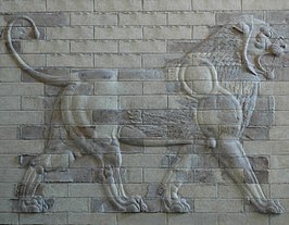
Tourism is an also important economic activity, linked to ancient sites such as the Tomb of Daniel, the tomb of the third-century poet Debel Khozaei, the ancient Elamite Chogha Zanbil ziggurat from the 14th or 13th century, and the ruins and archaeological site of the ancient city of Susa. Chogha Zanbil, located near Susa, was the first Iranian monument to be listed on the UNESCO World Heritage List in 1979.
The weather in Shush has very hot summers that may reach above 50 degrees Celsius and mild and rainy winters. Snowfall in this city is a very rare event. But in 2020, for the first time, the city of Shush witnessed snowfall, which led to the happiness of the people of this city.[9]
-
 Darwish market, 2004
 -


 Iran portal

Notes
References
- ^ OpenStreetMap contributors (8 August 2023). "Shush, Shush County" (Map). OpenStreetMap. Retrieved 8 August 2023.
- ^ "Statistical Center of Iran > Home".
- ^ Shush, Iran can be found at GEOnet Names Server, at this link, by opening the Advanced Search box, entering "-3085498" in the "Unique Feature Id" form, and clicking on "Search Database".
- ^ Habibi, Hassan. "Approval of the organization and chain of citizenship of the elements and units of the national divisions of Khuzestan province, centered in the city of Ahvaz". Islamic Parliament Research Center (in Persian). Ministry of Interior, Political and Defense Commission of the Government Board. Archived from the original on 17 July 2014. Retrieved 25 January 2024.
- ^ "Census of the Islamic Republic of Iran, 1385 (2006)". AMAR (in Persian). The Statistical Center of Iran. p. 06. Archived from the original (Excel) on 20 September 2011. Retrieved 25 September 2022.
- ^ "Census of the Islamic Republic of Iran, 1390 (2011)". Syracuse University (in Persian). The Statistical Center of Iran. p. 06. Archived from the original (Excel) on 18 January 2023. Retrieved 19 December 2022.
- ^ "Census of the Islamic Republic of Iran, 1395 (2016)". AMAR (in Persian). The Statistical Center of Iran. p. 06. Archived from the original (Excel) on 21 October 2020. Retrieved 19 December 2022.
- ^ "The Dez Multipuropose Dam Project in Iran". San Jose State University. Retrieved 13 January 2015.
- ^ "بارش برف در خوزستان مردم را غافلگیر کرد - تسنیم". خبرگزاری تسنیم | Tasnim (in Persian). Retrieved 29 February 2024.
- v
- t
- e
Khuzestan Province, Iran

and cities
- Abadan's museum
- Gundishapur
- Acropole of Shush
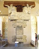
- Apadana in Susa
- Arjan castle, Behbahan
- Asak ancient city, Hendijan
- Chagadom tappe fire temple
- Chogha Mish Proto-Elamite site
- Chogha Zanbil
- Dav o Dokhtar castle, Ramhormoz
- Dez Dam
- Eshkaft-e Salman
- Gargar bridge, Shushtar
- Haft Tepe
- Hoor-al-azim lagoon
- Imamzadeh Roudband, Dezful
- Imamzadeh Sabz-e-ghaba, Dezful
- Karkheh Dam
- Khorramshahr mosque, Battle of Khorramshahr
- Kul-e Farah
- lake of Karkheh dam
- Lake of Karun
- Lali bridge
- Meyangaran lagoon
- Rangooni's mosque
- Salasel castle, Shushtar
- Shadegan lagoon
- Shevi waterfall, Dezful
- Shush-Daniel
- Shushtar Historical Hydraulic System
- Shushtar Watermills
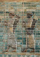
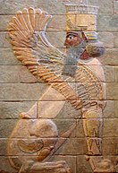
- Susa
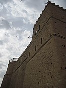
- Shush Castle
- Taryana
- Tobiron valley, Dezful
- Tomb of Daniel, Shush
- White bridge, Ahvaz
- Ya'qub-i Laith's tomb, Dezful

 | This Shush County location article is a stub. You can help Wikipedia by expanding it. |
- v
- t
- e


