Senga District
District in Northern Province, Zambia
Senga District | |
|---|---|
District | |
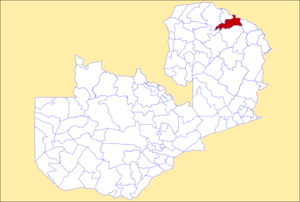 District location in Zambia | |
| Country |  Zambia Zambia |
| Province | Northern Province |
| Area | |
| • Total | 5,252 km2 (2,028 sq mi) |
| Population (2018) | |
| • Total | 127,604 |
| • Density | 24/km2 (63/sq mi) |
| Time zone | UTC+2 (CAT) |
Senga District (Swahili: Wilaya ya Senga) is a district of Northern Province, Zambia.[1][2] The district borders Tanzania's Songwe Region and Rukwa Region to the north. Senga was separated from Mbala District in 2016.[3]
References
- v
- t
- e
Districts of Zambia- Chibombo
- Chisamba
- Chitambo
- Kabwe
- Kapiri Mposhi
- Luano
- Mkushi
- Mumbwa
- Ngabwe
- Serenje
- Shibuyunji
 | This Zambia location article is a stub. You can help Wikipedia by expanding it. |
- v
- t
- e


