Sơn Trà district
You can help expand this article with text translated from the corresponding article in Vietnamese. (March 2009) Click [show] for important translation instructions.
- View a machine-translated version of the Vietnamese article.
- Machine translation, like DeepL or Google Translate, is a useful starting point for translations, but translators must revise errors as necessary and confirm that the translation is accurate, rather than simply copy-pasting machine-translated text into the English Wikipedia.
- Do not translate text that appears unreliable or low-quality. If possible, verify the text with references provided in the foreign-language article.
- You must provide copyright attribution in the edit summary accompanying your translation by providing an interlanguage link to the source of your translation. A model attribution edit summary is
Content in this edit is translated from the existing Vietnamese Wikipedia article at [[:vi:Sơn Trà (quận)]]; see its history for attribution. - You may also add the template
{{Translated|vi|Sơn Trà (quận)}}to the talk page. - For more guidance, see Wikipedia:Translation.
Urban district in South Central Coast, Vietnam
Sơn Trà district Quận Sơn Trà | |
|---|---|
 | |
 Seal | |
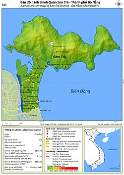 Administration map of the district in Da Nang | |
| Country |  Vietnam Vietnam |
| Region | South Central Coast |
| Municipality | Da Nang |
| Capital | Da Nang |
| Area | |
| • Total | 20 sq mi (60 km2) |
| Population (2018) | |
| • Total | 173,455 |
| Time zone | UTC+7 (Indochina Time) |
Sơn Trà is an urban district (quận) of Da Nang in the South Central Coast region of Vietnam. As of 2003 the district had a population of 112,196. The district covers an area of 60 km².[1] The district is bounded by ocean to the north and east, the Hàn River to the west, and Ngũ Hành Sơn district to the south. Sơn Trà Mountain occupies a large portion of the district.

The district is divided into 7 wards (phường):
- An Hải Bắc
- An Hải Đông
- An Hải Tây
- Mân Thái
- Nại Hiên Đông
- Phước Mỹ
- Thọ Quang
The district capital lies at An Hải Tây ward.
References
- ^ "Districts of Vietnam". Statoids. Retrieved March 20, 2009.
16°06′58″N 108°16′37″E / 16.116°N 108.277°E / 16.116; 108.277
- v
- t
- e
Districts of the Vietnamese South Central Coast
- Urban districts
- Cẩm Lệ
- Hải Châu※
- Liên Chiểu
- Ngũ Hành Sơn
- Sơn Trà
- Thanh Khê
- Hòa Vang
- Hoàng Sa§

- Cam Ranh city
- Nha Trang city※
- Ninh Hòa town
- Cam Lâm
- Diên Khánh
- Khánh Sơn
- Khánh Vĩnh
- Trường Sa§
- Vạn Ninh
※ denotes provincial seat. / § Sovereignty over the Hoàng Sa and Trường Sa archipelagoes is disputed as of 18 June 2024.
Authority control databases | |
|---|---|
| International |
|
| National |
|


