NSDAP administrative units, 1944Map of Nazi Germany with Reichsgaue highlighted
A Reichsgau (plural Reichsgaue) was an administrative subdivision created in a number of areas annexed by Nazi Germany between 1938 and 1945.
Overview
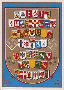
Propaganda postcard of Nazi Germany depicting the Gaue of the Reich (October 1939)
The term was formed from the words Reich (realm, empire) and Gau, the latter a deliberately medieval-sounding word with a meaning approximately equivalent to shire. The Reichsgaue were an attempt to resolve the administrative chaos resulting from the mutually overlapping jurisdictions and different boundaries of the NSDAP Party Gaue, placed under a Party Gauleiter, and the federal states, under a Reichsstatthalter responsible to the Ministry of the Interior (in the Prussian provinces, the equivalent post was that of Oberpräsident). Interior Minister Wilhelm Frick had long desired to streamline the German administration, and the Reichsgaue were the result: the borders of party Gaue and those of the federal states were to be identical, and the party Gauleiter also occupied the post of Reichsstatthalter. Rival interests and the influence the Gauleiter wielded with Hitler prevented any reform from being undertaken in the "Old Reich" (German: Altreich), which meant Germany in its borders of 1937 before the annexation of other territories like Austria, the Sudetenland, and Bohemia, and the Reichsgau scheme was therefore implemented only in newly-acquired territories.
There were several Reichsgaue:
East March (German: Ostmark) formed from the formerly independent Austria
Sudetenland, formed from a substantial part of the German-speaking outer rim areas of the former Czechoslovakia occupied in 1938
Danzig-West Prussia (German: Danzig-Westpreußen) and Wartheland, formed from the Free City of Danzig and areas annexed from Poland
The East March was subsequently subdivided into seven smaller Reichsgaue, generally coterminous with the former Austrian Länder (federal provinces).
List of Reichsgaue
Reichsgaue in Austria and parts of Czechoslovakia established in 1938
Formed from the former Austrian federal state of Lower Austria and northern Burgenland; included from 1939 on parts of southern Moravia, southeastern Bohemia and the two Bratislava boroughs of Devín and Petržalka. In 1943, Hitler toured Reichsgau Niederdonau and assured GauleiterHugo Jury that the capital would be Brünn (Brno) in the near future.[1]
Formed primarily in the Polish region of the Poznań Voivodeship as well as southern areas of Pomeranian and the western half of Łódź Voivodeship after the German occupation of Poland.
Reichsgaue (partly) formed out of pre-existing Gaue
Belgrade (Belgrad, or to be renamed to Prinz-Eugen-Stadt)
To be formed out of the Yugoslavian territories of Bačka, Syrmia, and Banat, parts of Transylvania (Siebenbürgen) and Baranya. To be named for Prince Eugene of Savoy (1663–1736), Austrian general who had a famous victory at the Siege of Belgrade (1688).
To be formed out of the southern parts of conquered Poland between the area west of Kraków to the San river in the east. It was to substantially correspond to the upper Vistula river basin. It was to be almost identical in size to Weichselland and Galizien. Named for the Beskids mountain range.
^Bryant, C.C. (2007). Prague in black: Nazi rule and Czech nationalism, Harvard University Press, ISBN 0-674-02451-6, p. 125
^Hans Rudolf Fuhrer (1982). Spionage gegen die Schweiz. Huber. p. 68. ISBN 3-274-00003-5.
^Jeremy Noakes; Geoffrey Pridham (1995). Nazism, 1919-1945: Foreign policy, war and racial extermination. University of Exeter Press. p. 882. ISBN 0-85989-474-6.
Sources
Der große Atlas der Weltgeschichte(in German), Historical map book, published: 1990, publisher: Orbis Verlag - Munich, ISBN 3-572-04755-2