Parliamentary constituency in the United Kingdom, 1974 onwards
| Northampton North |
|---|
Borough constituency
for the House of Commons |
 Boundary of Northampton North in Northamptonshire |
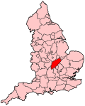 Location of Northamptonshire within England |
| County | Northamptonshire |
|---|
| Electorate | 58,324 (2018)[1] |
|---|
| Major settlements | Northampton (part) |
|---|
| Current constituency |
|---|
| Created | 1974 (1974) |
|---|
| Member of Parliament | Michael Ellis (Conservative) |
|---|
| Seats | One |
|---|
| Created from | Northampton |
|---|
Northampton North is a constituency[n 1] represented in the House of Commons of the UK Parliament since 2010 by Michael Ellis, a Conservative.[n 2] The constituency is a considered a bellwether, as it has reflected the national result at every general election since it was created in February 1974.
History
This constituency was created for the election of February 1974 when the old constituency of Northampton was split into Northampton North and Northampton South.
Since creation it has been a bellwether, electing an MP from the winning (or largest governing) party in every general election.
Boundaries

Map of current boundaries
1974–1983: The County Borough of Northampton wards of Abington, Dallington, Kingsthorpe, Park, St David, and St George.[2]
1983–2010: The Borough of Northampton wards of Abington, Boughton Green, Dallington and Kings Heath, Headlands, Kingsthorpe, Lings, Lumbertubs, Park, St Alban, St George, Thorplands, and Welford.
2010–present: The Borough of Northampton wards of Abington, Boughton Green, Eastfield, Headlands, Kingsley, Kingsthorpe, Lumbertubs, Parklands, St David, and Thorplands.
Proposed
Further to the 2023 Periodic Review of Westminster constituencies, enacted by the Parliamentary Constituencies Order 2023, the constituency from the next general election, due by January 2025, will be composed of the following wards in the District of West Northamptonshire (as they existed on 1 April 2021):
Abington and Phippsville; Boothville and Parklands; Castle; Dallington Spencer; Headlands; Kingsthorpe North; Kingsthorpe South; St. George; Talavera.[3]
The constituency will be expanded considerably with the addition of Northampton town centre from Northampton South.
Constituency profile
The constituency has income, social housing and unemployment statistics[4] close to the national average. There is a varied and dynamic service and engineering-centred economy typical of the East Midlands, with significant foodstuffs, clothing and consumables manufacturing and processing operations.[5] Health inequality is high, with the life expectancy gap between the least deprived and most deprived men in Northampton reaching over a decade.[6] According to Public Health England, the constituency is "considerably worse than [the] England average" in terms of violent crime, self harm, under 18 conception and GCSE achievement.[6]
Members of Parliament
Elections
Elections in the 2020s
Elections in the 2010s
General election 2019: Northampton North[11] | Party | Candidate | Votes | % | ±% |
| | Conservative | Michael Ellis | 21,031 | 53.2 | +6.0 |
| | Labour | Sally Keeble | 15,524 | 39.3 | -5.9 |
| | Liberal Democrats | Martin Sawyer | 2,031 | 5.1 | +2.6 |
| | Green | Katherine Pate | 953 | 2.4 | +0.8 |
| Majority | 5,507 | 13.9 | +11.9 |
| Turnout | 39,539 | 66.7 | -2.0 |
| | Conservative hold | Swing | +6.0 | |
General election 2010: Northampton North[16][17] | Party | Candidate | Votes | % | ±% |
| | Conservative | Michael Ellis | 13,735 | 34.1 | +4.4 |
| | Labour | Sally Keeble | 11,799 | 29.3 | −10.9 |
| | Liberal Democrats | Andrew Simpson | 11,250 | 27.9 | +1.0 |
| | BNP | Ray Beasley | 1,316 | 3.3 | New |
| | UKIP | Jim MacArthur | 1,238 | 3.1 | +0.6 |
| | Green | Tony Lochmuller | 443 | 1.1 | New |
| | Independent | Eamonn Fitzpatrick | 334 | 0.8 | New |
| | Christian | Timothy Webb | 98 | 0.2 | New |
| | Independent | Malcolm Mildren | 58 | 0.1 | New |
| Majority | 1,936 | 4.8 | N/A |
| Turnout | 40,271 | 62.7 | +5.5 |
| | Conservative gain from Labour | Swing | +6.9 | |
Elections in the 2000s
General election 2005: Northampton North[18] | Party | Candidate | Votes | % | ±% |
| | Labour | Sally Keeble | 16,905 | 40.2 | -9.2 |
| | Conservative | Damian Collins | 12,945 | 30.8 | +0.4 |
| | Liberal Democrats | Andrew Simpson | 10,317 | 24.5 | +6.8 |
| | UKIP | John Howsam | 1,050 | 2.5 | +1.1 |
| | SOS! Northampton | Paul Witherington | 495 | 1.2 | New |
| | CPA | Andrew Otchie | 336 | 0.8 | New |
| Majority | 3,960 | 9.4 | -9.6 |
| Turnout | 42,048 | 57.9 | +1.9 |
| | Labour hold | Swing | -4.8 | |
General election 2001: Northampton North[19] | Party | Candidate | Votes | % | ±% |
| | Labour | Sally Keeble | 20,507 | 49.4 | -3.3 |
| | Conservative | John Whelan | 12,614 | 30.4 | -3.0 |
| | Liberal Democrats | Richard Church | 7,363 | 17.7 | +5.0 |
| | UKIP | Dusan Torbica | 596 | 1.4 | +0.5 |
| | Socialist Alliance | Gordon White | 414 | 1.0 | New |
| Majority | 7,893 | 19.0 | 0.0 |
| Turnout | 41,494 | 56.0 | -14.1 |
| | Labour hold | Swing | -3.15 | |
Elections in the 1990s
General election 1992: Northampton North[21][22] | Party | Candidate | Votes | % | ±% |
| | Conservative | Tony Marlow | 24,865 | 45.8 | -2.0 |
| | Labour | JM Thomas | 20,957 | 38.6 | +8.7 |
| | Liberal Democrats | R. Church | 8,236 | 15.2 | -5.9 |
| | Natural Law | B Spivack | 232 | 0.4 | New |
| Majority | 3,908 | 7.2 | −10.7 |
| Turnout | 54,290 | 78.5 | +3.9 |
| | Conservative hold | Swing | −5.4 | |
Elections in the 1980s
General election 1987: Northampton North[23] | Party | Candidate | Votes | % | ±% |
| | Conservative | Tony Marlow | 24,816 | 47.8 | +0.8 |
| | Labour | Owen Granfield | 15,560 | 29.9 | +3.0 |
| | Liberal | Tony Rounthwaite | 10,960 | 21.1 | -5.0 |
| | Green | Michael Green | 471 | 0.9 | New |
| | Workers Revolutionary | S. Colling | 156 | 0.3 | New |
| Majority | 9,256 | 17.9 | -2.2 |
| Turnout | 51,963 | 74.6 | |
| | Conservative hold | Swing | -1.1 | |
General election 1983: Northampton North[24] | Party | Candidate | Votes | % | ±% |
| | Conservative | Tony Marlow | 23,129 | 47.0 | |
| | Labour | David Offenbach | 13,269 | 26.9 | |
| | Liberal | Anthony Rounthwaite | 12,829 | 26.1 | |
| Majority | 9,860 | 20.1 | |
| Turnout | 49,227 | | |
| | Conservative hold | Swing | | |
Elections in the 1970s
See also
Notes
- ^ A borough constituency (for the purposes of election expenses and type of returning officer)
- ^ As with all constituencies, the constituency elects one Member of Parliament (MP) by the first past the post system of election at least every five years.
References
- ^ "England Parliamentary electorates 2010-2018". Boundary Commission for England. Retrieved 23 March 2019.
- ^ "The Parliamentary Constituencies (Daventry, Wellingborough and Northampton) Order 1973", legislation.gov.uk, The National Archives, SI 1973/604, retrieved 26 February 2023
- ^ "The Parliamentary Constituencies Order 2023". Schedule I Part I.
- ^ Unemployment claimants by constituency The Guardian
- ^ "2011 Census Interactive - ONS". ons.gov.uk. Archived from the original on 29 January 2016.
- ^ a b "E07000154". fingertips.phe.org.uk.
- ^ Leigh Rayment's Historical List of MPs – Constituencies beginning with "N" (part 3)
- ^ "Ambulance wait times in Northampton referenced at Prime Minister's Questions as Rishi Sunak and Keir Starmer clash". Northampton Chronicle and Echo. Retrieved 4 February 2023.
- ^ "West Northamptonshire Liberal Democrats: Northampton North". www.westnorthantslibdems.org.uk. Retrieved 4 February 2023.
- ^ "Reform UK: Northampton North". www.reformparty.uk. Retrieved 9 March 2023.
- ^ "Northampton North Parliamentary constituency". BBC News. BBC. Retrieved 21 November 2019.
- ^ "BBC Local Live: Northamptonshire". BBC News. Retrieved 14 April 2019.
- ^ "Election Data 2015". Electoral Calculus. Archived from the original on 17 October 2015. Retrieved 17 October 2015.
- ^ "Northampton North". northamptonnorth.com. Archived from the original on 5 May 2015. Retrieved 20 April 2020.
- ^ "- Green Party Members' Website". greenparty.org.uk.
- ^ "Election Data 2010". Electoral Calculus. Archived from the original on 26 July 2013. Retrieved 17 October 2015.
- ^ "BBC News - Election 2010 - Constituency - Northampton North". bbc.co.uk.
- ^ "Election Data 2005". Electoral Calculus. Archived from the original on 15 October 2011. Retrieved 18 October 2015.
- ^ "Election Data 2001". Electoral Calculus. Archived from the original on 15 October 2011. Retrieved 18 October 2015.
- ^ "Election Data 1997". Electoral Calculus. Archived from the original on 15 October 2011. Retrieved 18 October 2015.
- ^ "Election Data 1992". Electoral Calculus. Archived from the original on 15 October 2011. Retrieved 18 October 2015.
- ^ "Politics Resources". Election 1992. Politics Resources. 9 April 1992. Archived from the original on 24 July 2011. Retrieved 6 December 2010.
- ^ "Election Data 1987". Electoral Calculus. Archived from the original on 15 October 2011. Retrieved 18 October 2015.
- ^ "Election Data 1983". Electoral Calculus. Archived from the original on 15 October 2011. Retrieved 18 October 2015.
Sources
- Election Demon 1997–2005. English Boroughs Leicester East to Wythenshawe and Sale East
Constituencies in the East Midlands (46)
| Conservative (35) | - Amber Valley
- Bassetlaw
- Bolsover
- Boston and Skegness
- Bosworth
- Broxtowe
- Charnwood
- Corby
- Daventry
- Derby North
- Derbyshire Dales
- Erewash
- Gainsborough
- Gedling
- Grantham and Stamford
- Harborough
- High Peak
- Kettering
- Lincoln
- Loughborough
- Louth and Horncastle
- Mansfield
- Mid Derbyshire
- Newark
- Northampton North
- Northampton South
- North East Derbyshire
- Rushcliffe
- Rutland and Melton
- Sherwood
- Sleaford and North Hykeham
- South Derbyshire
- South Holland and The Deepings
- South Leicestershire
- South Northamptonshire
|
|---|
| Labour (8) | - Chesterfield
- Derby South
- Leicester South
- Leicester West
- Nottingham East
- Nottingham North
- Nottingham South
- Wellingborough
|
|---|
| Independent (2) | - Leicester East
- North West Leicestershire
|
|---|
| Reform UK (1) | |
|---|
- East Midlands
- East of England
- London
- North East England
- North West England
- Northern Ireland
- Scotland
- South East England
- South West England
- Wales
- West Midlands
- Yorkshire and the Humber
|
|
|---|
| Suburbs and villages | | |
|---|
| Governance | |
|---|
| Culture | | Places of interest | |
|---|
| Entertainment | |
|---|
| Shopping | |
|---|
| Parks | |
|---|
| Events | |
|---|
|
|---|
| Education | |
|---|
| Sport | |
|---|
| Transport | |
|---|
|
Authority control databases: People  | |
|---|
52°16′N 0°52′W / 52.26°N 0.87°W / 52.26; -0.87


