Niederwaldkirchen
Place in Upper Austria, Austria

Coat of arms
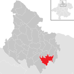
Location in the district
(2018-01-01)[2]
4174
Niederwaldkirchen is a municipality in the district of Rohrbach in the Austrian state of Upper Austria.
Population
| Year | Pop. | ±% |
|---|---|---|
| 1869 | 1,659 | — |
| 1880 | 1,674 | +0.9% |
| 1890 | 1,657 | −1.0% |
| 1900 | 1,579 | −4.7% |
| 1910 | 1,549 | −1.9% |
| 1923 | 1,477 | −4.6% |
| 1934 | 1,566 | +6.0% |
| 1939 | 1,500 | −4.2% |
| 1951 | 1,481 | −1.3% |
| 1961 | 1,583 | +6.9% |
| 1971 | 1,578 | −0.3% |
| 1981 | 1,612 | +2.2% |
| 1991 | 1,754 | +8.8% |
| 2001 | 1,791 | +2.1% |
| 2011 | 1,758 | −1.8% |
| 2017 | 1,799 | +2.3% |
References
Wikimedia Commons has media related to Niederwaldkirchen.
- v
- t
- e
Municipalities in the district of Rohrbach
- Aigen-Schlägl
- Altenfelden
- Arnreit
- Atzesberg
- Auberg
- Haslach an der Mühl
- Helfenberg
- Hofkirchen im Mühlkreis
- Hörbich
- Julbach
- Kirchberg ob der Donau
- Klaffer am Hochficht
- Kleinzell im Mühlkreis
- Kollerschlag
- Lembach im Mühlkreis
- Lichtenau im Mühlkreis
- Nebelberg
- Neufelden
- Neustift im Mühlkreis
- Niederkappel
- Niederwaldkirchen
- Oberkappel
- Oepping
- Peilstein im Mühlviertel
- Pfarrkirchen im Mühlkreis
- Putzleinsdorf
- Rohrbach-Berg
- Sankt Johann am Wimberg
- Sankt Martin im Mühlkreis
- Sankt Oswald bei Haslach
- Sankt Peter am Wimberg
- Sankt Stefan-Afiesl
- Sankt Ulrich im Mühlkreis
- Sankt Veit im Mühlkreis
- Sarleinsbach
- Schwarzenberg am Böhmerwald
- Ulrichsberg
Authority control databases | |
|---|---|
| International |
|
| National |
|
 | This Upper Austria location article is a stub. You can help Wikipedia by expanding it. |
- v
- t
- e


