Mountbatten, Singapore
Subzone of Marine Parade Planning Area in Singapore
1°18′51″N 103°49′44″E / 1.3142°N 103.8288°E / 1.3142; 103.8288Mountbatten (also known as Mountbatten Estate)[1] is a neighbourhood located in the planning area of Marine Parade, Singapore.
History
The neighbourhood is named after Lord Louis Mountbatten, the Supreme Allied Commander of the South East Asia Command, Governor General of India and British Military Administrator of Malaya from 1945 to 1946.
Layout
Mountbatten Road is a major thoroughfare that stretches all the way from the junction with Nicoll Highway, Guillemard Road and Sims Way (where Kallang Airport Way branches out from Sims Way) in Kallang to Haig Road in Katong where it continues eastward as East Coast Road.[2][3]
Points of interest
- Katong Community Centre (formally Mountbatten CC)[4]
- Goodman Arts Centre (former LASALLE College of the Arts)[5]
- Sing Hoe Hotel (formerly Sin Hoe)[2]
- Katong Shopping Centre
- Liv@MB[6]
- Chung Cheng High School (Main)
- Meyer Blue[7]
Transportation
Mountbatten is served by Mountbatten MRT station and Dakota MRT station on the Circle MRT line. Both stations are situated under Old Airport Road.
Gallery
-
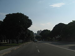 A view of Mountbatten Road in Singapore
 -
 A view of Mountbatten Road in Singapore
 -
 A view of Mountbatten Road in Singapore
 -
 A view of Mountbatten Road in Singapore
 -
 A view of Mountbatten Road in Singapore
 -
 The junction of Mountbatten Road, Nicoll Highway, Sims Way and Guillemard Road.


References
- ^ "Mountbatten Estate | Infopedia". eresources.nlb.gov.sg. Retrieved 26 March 2021.
- ^ a b Singapore, Remember (6 September 2016). "The Old World Charm of Mountbatten". Remember Singapore. Retrieved 26 March 2021.
- ^ Singapore Guide and Street Directory. University of Michigan. 1972.
- ^ "onePA - Katong CC". onePA. Retrieved 26 March 2021.
- ^ "Goodman Arts Centre (former Laselle College of the Arts)". www.roots.gov.sg. Retrieved 26 March 2021.
- ^ "Liv @ MB | Arthur Road, Mountbatten, Singapore". Liv @ MB Condo | Located at Arthur Road By Bukit Sembawang. Retrieved 26 March 2021.
- ^ "Meyer Blue | Meyer Road, Singapore". Meyer Blue Condo | Located at Meyer Road by UOL & Singapore Land. Retrieved 26 April 2024.
- v
- t
- e
Places in Singapore by region
Listed by planning areas (Subzones in parentheses)
- Central Area (City centre)
- Bishan
- Bukit Merah
- Alexandra Hill
- Alexandra North
- Bukit Ho Swee
- Bukit Merah
- Depot Road
- Everton Park
- HarbourFront/Maritime Square
- Henderson Hill
- Kampong Tiong Bahru
- Redhill
- Singapore General Hospital
- Telok Blangah Drive
- Telok Blangah Rise
- Telok Blangah Way
- Tiong Bahru
- Bukit Timah
- Anak Bukit
- Coronation Road
- Farrer Court
- Hillcrest
- Holland Road
- Leedon Park
- Swiss Club
- Ulu Pandan
- Downtown Core
- Anson
- Bayfront Subzone
- Bugis
- Cecil
- Central Subzone
- City Hall
- Clifford Pier
- Marina Centre
- Maxwell
- Millenia Singapore
- Nicoll
- Phillip
- Raffles Place
- Tanjong Pagar
- Geylang
- Aljunied
- Geylang East
- Kallang Way
- Kampong Ubi
- MacPherson
- Kallang
- Marina East
- Marina South
- Marine Parade
- East Coast
- Katong
- Marina East
- Marine Parade
- Mountbatten
- Museum
- Newton
- Cairnhill
- Goodwood Park
- Istana Negara
- Monk's Hill
- Newton Circus
- Orange Grove
- Novena
- Balestier
- Dunearn
- Malcolm
- Moulmein
- Mount Pleasant
- Orchard
- Boulevard
- Somerset
- Tanglin
- Outram
- China Square
- Chinatown
- Pearl's Hill
- People's Park
- Queenstown
- Commonwealth
- Dover
- Ghim Moh
- Kent Ridge
- Margaret Drive
- Mei Chin
- National University of Singapore
- one-north
- Pasir Panjang 1
- Pasir Panjang 2
- Tanglin Halt
- Queensway
- River Valley
- Institution Hill
- Leonie Hill
- One Tree Hill
- Oxley
- Paterson
- Rochor
- Bencoolen
- Farrer Park
- Kampong Glam
- Little India
- Mackenzie
- Mount Emily
- Rochor Canal
- Selegie
- Sungei Road
- Victoria
- Singapore River
- Southern Islands
- Straits View
- Tanglin
- Chatsworth
- Nassim
- Ridout
- Tyersall
- Toa Payoh
- Bidadari
- Boon Teck
- Braddell
- Joo Seng
- Kim Keat
- Lorong 8 Toa Payoh
- Pei Chun
- Potong Pasir
- Sennett
- Toa Payoh Central
- Toa Payoh West
- Woodleigh
- Bedok
- Bayshore
- Bedok North
- Reservoir
- Bedok South
- Frankel
- Kaki Bukit
- Kembangan
- Siglap
- Changi
- Airport
- Changi Point
- Changi West
- Changi Bay
- Pasir Ris
- Flora Drive
- Loyang East
- Loyang West
- Pasir Ris Central
- Pasir Ris Drive
- Pasir Ris Park
- Pasir Ris Wafer Fab Park
- Pasir Ris West
- Paya Lebar
- Airport Road, Singapore
- Paya Lebar East
- Paya Lebar North
- Paya Lebar West
- Plab
- Tampines
- Central Water Catchment
- Lim Chu Kang
- Mandai
- Mandai East
- Mandai Estate
- Mandai West
- Sembawang
- Admiralty
- Sembawang Central
- Sembawang East
- Sembawang North
- Sembawang Spring
- Sembawang Straits
- Senoko North
- Senoko South
- The Wharves
- Simpang
- Pulau Seletar
- Simpang North
- Simpang South
- Tanjong Irau
- Sungei Kadut
- Woodlands
- Greenwood Park
- Midview
- North Coast
- Senoko West
- Woodgrove
- Woodlands East
- Woodlands Regional Centre
- Woodlands South
- Woodlands West
- Yishun
- Khatib
- Lower Seletar
- Nee Soon
- Northland
- Springleaf
- Yishun Central
- Yishun East
- Yishun South
- Yishun West
- Ang Mo Kio
- Ang Mo Kio Town Centre
- Cheng San
- Chong Boon
- Kebun Baru
- Sembawang Hills
- Shangri-la
- Tagore
- Townsville, Singapore
- Yio Chu Kang
- Yio Chu Kang East
- Yio Chu Kang North
- Yio Chu Kang West
- Hougang
- Defu Industrial Park
- Hougang Central
- Hougang East
- Hougang West
- Kangkar
- Kovan
- Lorong Ah Soo
- Lorong Halus
- Tai Seng
- Trafalgar
- North-Eastern Islands
- Punggol
- Coney Island
- Matilda
- Northshore
- Punggol Canal
- Punggol Field
- Punggol Town Centre
- Waterway East
- Seletar
- Pulau Punggol Barat
- Pulau Punggol Timor
- Seletar
- Aerospace Park
- Sengkang
- Anchorvale
- Compassvale
- Fernvale
- Jalan Kayu
- Lorong Halus North
- Rivervale
- Sengkang Town Centre
- Sengkang West
- Serangoon
- Lorong Chuan
- Seletar Hills
- Serangoon Central
- Serangoon Garden
- Serangoon North
- Serangoon North Industrial Estate
- Upper Paya Lebar
- Boon Lay
- Bukit Batok
- Bukit Panjang
- Bangkit
- Dairy Farm
- Fajar
- Jelebu
- Nature Reserve
- Saujana
- Senja
- Choa Chu Kang
- Clementi
- Clementi Central
- Clementi North
- Clementi West
- Clementi Woods
- Faber
- Pandan
- Sunset Way
- Toh Tuck
- West Coast
- Jurong East
- Jurong West
- Pioneer
- Benoi Sector
- Gul Basin
- Gul Circle
- Joo Koon
- Pioneer Sector
- Tengah
- Tuas
- Tengeh
- Tuas Bay
- Tuas North
- Tuas Promenade
- Tuas View
- Tuas View Extension
- Western Islands
- Western Water Catchment
 | This Singapore location article is a stub. You can help Wikipedia by expanding it. |
- v
- t
- e


