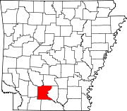
List of lakes of Ouachita County, Arkansas
Map all coordinates using OpenStreetMap
Download coordinates as:
- KML
- GPX (all coordinates)
- GPX (primary coordinates)
- GPX (secondary coordinates)
There are at least 44 named lakes and reservoirs in Ouachita County, Arkansas.
Lakes
- Bacon Lake, 33°48′01″N 092°52′31″W / 33.80028°N 92.87528°W / 33.80028; -92.87528 (Bacon Lake), el. 112 feet (34 m) [1]
- Ben Davis Lake, 33°23′35″N 092°39′11″W / 33.39306°N 92.65306°W / 33.39306; -92.65306 (Ben Davis Lake), el. 79 feet (24 m) [2]
- Big Dixon Lake, 33°43′10″N 092°50′50″W / 33.71944°N 92.84722°W / 33.71944; -92.84722 (Big Dixon Lake), el. 108 feet (33 m) [3]
- Blue Lake, 33°35′28″N 092°46′15″W / 33.59111°N 92.77083°W / 33.59111; -92.77083 (Blue Lake), el. 89 feet (27 m) [4]
- Burks Pond, 33°39′04″N 092°45′54″W / 33.65111°N 92.76500°W / 33.65111; -92.76500 (Burks Pond), el. 115 feet (35 m) [5]
- Fishers Lake, 33°37′34″N 092°49′39″W / 33.62611°N 92.82750°W / 33.62611; -92.82750 (Fishers Lake), el. 89 feet (27 m) [6]
- Georgia Lake, 33°46′06″N 092°52′11″W / 33.76833°N 92.86972°W / 33.76833; -92.86972 (Georgia Lake), el. 108 feet (33 m) [7]
- Grayson Pond, 33°39′11″N 093°06′27″W / 33.65306°N 93.10750°W / 33.65306; -93.10750 (Grayson Pond), el. 213 feet (65 m) [8]
- Hook Lake, 33°37′00″N 092°49′04″W / 33.61667°N 92.81778°W / 33.61667; -92.81778 (Hook Lake), el. 98 feet (30 m) [9]
- Little Dixon Lake, 33°42′46″N 092°50′50″W / 33.71278°N 92.84722°W / 33.71278; -92.84722 (Little Dixon Lake), el. 108 feet (33 m) [10]
- Little Johnson Lake, 33°35′53″N 092°46′52″W / 33.59806°N 92.78111°W / 33.59806; -92.78111 (Little Johnson Lake), el. 89 feet (27 m) [11]
- Lower Old Brake, 33°39′55″N 092°52′46″W / 33.66528°N 92.87944°W / 33.66528; -92.87944 (Lower Old Brake), el. 112 feet (34 m) [12]
- Lower Old River, 33°38′04″N 092°50′10″W / 33.63444°N 92.83611°W / 33.63444; -92.83611 (Lower Old River), el. 89 feet (27 m) [13]
- Moon Lake, 33°42′07″N 092°53′07″W / 33.70194°N 92.88528°W / 33.70194; -92.88528 (Moon Lake), el. 98 feet (30 m) [14]
- Mustin Lake, 33°34′22″N 092°45′17″W / 33.57278°N 92.75472°W / 33.57278; -92.75472 (Mustin Lake), el. 95 feet (29 m) [15]
- Pedron Lake, 33°31′11″N 092°46′24″W / 33.51972°N 92.77333°W / 33.51972; -92.77333 (Pedron Lake), el. 89 feet (27 m) [16]
- Pine Lake, 33°38′50″N 092°50′00″W / 33.64722°N 92.83333°W / 33.64722; -92.83333 (Pine Lake), el. 95 feet (29 m) [17]
- Round Lake, 33°35′02″N 092°46′28″W / 33.58389°N 92.77444°W / 33.58389; -92.77444 (Round Lake), el. 89 feet (27 m) [18]
- Tate Lake, 33°44′24″N 092°53′05″W / 33.74000°N 92.88472°W / 33.74000; -92.88472 (Tate Lake), el. 105 feet (32 m) [19]
- Toney Old River, 33°41′39″N 092°52′12″W / 33.69417°N 92.87000°W / 33.69417; -92.87000 (Toney Old River), el. 92 feet (28 m) [20]
- Treadway Slough, 33°35′04″N 092°49′02″W / 33.58444°N 92.81722°W / 33.58444; -92.81722 (Treadway Slough), el. 89 feet (27 m) [21]
- Upper Old Brake, 33°41′14″N 092°53′32″W / 33.68722°N 92.89222°W / 33.68722; -92.89222 (Upper Old Brake), el. 105 feet (32 m) [22]
- Utley Lake, 33°45′19″N 092°51′33″W / 33.75528°N 92.85917°W / 33.75528; -92.85917 (Utley Lake), el. 121 feet (37 m) [23]
- Walker Lake, 33°33′29″N 092°43′35″W / 33.55806°N 92.72639°W / 33.55806; -92.72639 (Walker Lake), el. 92 feet (28 m) [24]
- Webb Lake, 33°34′43″N 092°45′53″W / 33.57861°N 92.76472°W / 33.57861; -92.76472 (Webb Lake), el. 95 feet (29 m) [25]
- Woodard Lake, 33°36′29″N 092°46′33″W / 33.60806°N 92.77583°W / 33.60806; -92.77583 (Woodard Lake), el. 92 feet (28 m) [26]
Reservoirs
- Beavers Lake, 33°43′14″N 093°01′29″W / 33.72056°N 93.02472°W / 33.72056; -93.02472 (Beavers Lake), el. 239 feet (73 m) [27]
- Berg Lake, 33°35′00″N 092°52′01″W / 33.58333°N 92.86694°W / 33.58333; -92.86694 (Berg Lake), el. 161 feet (49 m) [28]
- Bragg Lake, 33°38′52″N 092°58′25″W / 33.64778°N 92.97361°W / 33.64778; -92.97361 (Bragg Lake), el. 144 feet (44 m) [29]
- Brigham Lake, 33°29′28″N 093°05′07″W / 33.49111°N 93.08528°W / 33.49111; -93.08528 (Brigham Lake), el. 256 feet (78 m) [30]
- Davis Lake, 33°24′21″N 093°02′32″W / 33.40583°N 93.04222°W / 33.40583; -93.04222 (Davis Lake), el. 213 feet (65 m) [31]
- Garner Lake Number One, 33°45′02″N 092°40′18″W / 33.75056°N 92.67167°W / 33.75056; -92.67167 (Garner Lake Number One), el. 197 feet (60 m) [32]
- Graysons Lake, 33°24′59″N 093°04′06″W / 33.41639°N 93.06833°W / 33.41639; -93.06833 (Graysons Lake), el. 223 feet (68 m) [33]
- Greenings Lake, 33°33′22″N 092°57′45″W / 33.55611°N 92.96250°W / 33.55611; -92.96250 (Greenings Lake), el. 167 feet (51 m) [34]
- Harvey Pond, 33°35′59″N 092°55′04″W / 33.59972°N 92.91778°W / 33.59972; -92.91778 (Harvey Pond), el. 184 feet (56 m) [35]
- Hassics Lake, 33°24′51″N 093°05′11″W / 33.41417°N 93.08639°W / 33.41417; -93.08639 (Hassics Lake), el. 203 feet (62 m) [36]
- Kennedy Pond, 33°36′25″N 092°53′31″W / 33.60694°N 92.89194°W / 33.60694; -92.89194 (Kennedy Pond), el. 213 feet (65 m) [37]
- Lake Darby, 33°32′09″N 092°53′54″W / 33.53583°N 92.89833°W / 33.53583; -92.89833 (Lake Darby), el. 144 feet (44 m) [38]
- Lake Landers, 33°29′15″N 092°58′37″W / 33.48750°N 92.97694°W / 33.48750; -92.97694 (Lake Landers), el. 246 feet (75 m) [39]
- Lower White Oak Lake, 33°42′06″N 093°05′49″W / 33.70167°N 93.09694°W / 33.70167; -93.09694 (Lower White Oak Lake), el. 190 feet (58 m) [40]
- Pace Lake, 33°32′48″N 093°03′35″W / 33.54667°N 93.05972°W / 33.54667; -93.05972 (Pace Lake), el. 236 feet (72 m) [41]
- Saxon Lake, 33°40′32″N 092°57′20″W / 33.67556°N 92.95556°W / 33.67556; -92.95556 (Saxon Lake), el. 154 feet (47 m) [42]
- Senrac Lake, 33°31′57″N 092°48′42″W / 33.53250°N 92.81167°W / 33.53250; -92.81167 (Senrac Lake), el. 105 feet (32 m) [43]
- Upper White Oak Lake, 33°39′07″N 093°05′17″W / 33.65194°N 93.08806°W / 33.65194; -93.08806 (Upper White Oak Lake), el. 203 feet (62 m) [44]
See also
Notes
- ^ "Bacon Lake". Geographic Names Information System. United States Geological Survey, United States Department of the Interior.
- ^ "Ben Davis Lake". Geographic Names Information System. United States Geological Survey, United States Department of the Interior.
- ^ "Big Dixon Lake". Geographic Names Information System. United States Geological Survey, United States Department of the Interior.
- ^ "Blue Lake". Geographic Names Information System. United States Geological Survey, United States Department of the Interior.
- ^ "Burks Pond". Geographic Names Information System. United States Geological Survey, United States Department of the Interior.
- ^ "Fishers Lake". Geographic Names Information System. United States Geological Survey, United States Department of the Interior.
- ^ "Georgia Lake". Geographic Names Information System. United States Geological Survey, United States Department of the Interior.
- ^ "Grayson Pond". Geographic Names Information System. United States Geological Survey, United States Department of the Interior.
- ^ "Hook Lake". Geographic Names Information System. United States Geological Survey, United States Department of the Interior.
- ^ "Little Dixon Lake". Geographic Names Information System. United States Geological Survey, United States Department of the Interior.
- ^ "Little Johnson Lake". Geographic Names Information System. United States Geological Survey, United States Department of the Interior.
- ^ "Lower Old Brake". Geographic Names Information System. United States Geological Survey, United States Department of the Interior.
- ^ "Lower Old River". Geographic Names Information System. United States Geological Survey, United States Department of the Interior.
- ^ "Moon Lake". Geographic Names Information System. United States Geological Survey, United States Department of the Interior.
- ^ "Mustin Lake". Geographic Names Information System. United States Geological Survey, United States Department of the Interior.
- ^ "Pedron Lake". Geographic Names Information System. United States Geological Survey, United States Department of the Interior.
- ^ "Pine Lake". Geographic Names Information System. United States Geological Survey, United States Department of the Interior.
- ^ "Round Lake". Geographic Names Information System. United States Geological Survey, United States Department of the Interior.
- ^ "Tate Lake". Geographic Names Information System. United States Geological Survey, United States Department of the Interior.
- ^ "Toney Old River". Geographic Names Information System. United States Geological Survey, United States Department of the Interior.
- ^ "Treadway Slough". Geographic Names Information System. United States Geological Survey, United States Department of the Interior.
- ^ "Upper Old Brake". Geographic Names Information System. United States Geological Survey, United States Department of the Interior.
- ^ "Utley Lake". Geographic Names Information System. United States Geological Survey, United States Department of the Interior.
- ^ "Walker Lake". Geographic Names Information System. United States Geological Survey, United States Department of the Interior.
- ^ "Webb Lake". Geographic Names Information System. United States Geological Survey, United States Department of the Interior.
- ^ "Woodard Lake". Geographic Names Information System. United States Geological Survey, United States Department of the Interior.
- ^ "Beavers Lake". Geographic Names Information System. United States Geological Survey, United States Department of the Interior.
- ^ "Berg Lake". Geographic Names Information System. United States Geological Survey, United States Department of the Interior.
- ^ "Bragg Lake". Geographic Names Information System. United States Geological Survey, United States Department of the Interior.
- ^ "Brigham Lake". Geographic Names Information System. United States Geological Survey, United States Department of the Interior.
- ^ "Davis Lake". Geographic Names Information System. United States Geological Survey, United States Department of the Interior.
- ^ "Garner Lake Number One". Geographic Names Information System. United States Geological Survey, United States Department of the Interior.
- ^ "Graysons Lake". Geographic Names Information System. United States Geological Survey, United States Department of the Interior.
- ^ "Greenings Lake". Geographic Names Information System. United States Geological Survey, United States Department of the Interior.
- ^ "Harvey Pond". Geographic Names Information System. United States Geological Survey, United States Department of the Interior.
- ^ "Hassics Lake". Geographic Names Information System. United States Geological Survey, United States Department of the Interior.
- ^ "Kennedy Pond". Geographic Names Information System. United States Geological Survey, United States Department of the Interior.
- ^ "Lake Darby". Geographic Names Information System. United States Geological Survey, United States Department of the Interior.
- ^ "Lake Landers". Geographic Names Information System. United States Geological Survey, United States Department of the Interior.
- ^ "Lower White Oak Lake". Geographic Names Information System. United States Geological Survey, United States Department of the Interior.
- ^ "Pace Lake". Geographic Names Information System. United States Geological Survey, United States Department of the Interior.
- ^ "Saxon Lake". Geographic Names Information System. United States Geological Survey, United States Department of the Interior.
- ^ "Senrac Lake". Geographic Names Information System. United States Geological Survey, United States Department of the Interior.
- ^ "Upper White Oak Lake". Geographic Names Information System. United States Geological Survey, United States Department of the Interior.
- v
- t
- e
Municipalities and communities of Ouachita County, Arkansas, United States
County seat: Camden
communities
‡This populated place also has portions in an adjacent county or counties
- Arkansas portal
- United States portal


