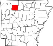
List of lakes of Newton County, Arkansas
Map all coordinates using OpenStreetMap
Download coordinates as:
- KML
- GPX (all coordinates)
- GPX (primary coordinates)
- GPX (secondary coordinates)
There are at least 9 named lakes and reservoirs in Newton County, Arkansas.
Lakes
According to the United States Geological Survey, there are no named lakes in Newton County, Arkansas.
Reservoirs
- Edwards Lake, 36°06′54″N 093°12′25″W / 36.11500°N 93.20694°W / 36.11500; -93.20694 (Edwards Lake), el. 1,086 feet (331 m) [1]
- Fowler Lake, 35°57′13″N 093°24′58″W / 35.95361°N 93.41611°W / 35.95361; -93.41611 (Fowler Lake), el. 2,106 feet (642 m) [2]
- Hurricane Lake, 35°54′15″N 092°57′51″W / 35.90417°N 92.96417°W / 35.90417; -92.96417 (Hurricane Lake), el. 997 feet (304 m) [3]
- Lower Hurricane Lake, 35°55′35″N 092°57′48″W / 35.92639°N 92.96333°W / 35.92639; -92.96333 (Lower Hurricane Lake), el. 902 feet (275 m) [4]
- Mill Creek Hollow Reservoir, 36°04′30″N 093°08′13″W / 36.07500°N 93.13694°W / 36.07500; -93.13694 (Mill Creek Hollow Reservoir), el. 820 feet (250 m) [5]
- North Pond, 36°03′18″N 093°10′48″W / 36.05500°N 93.18000°W / 36.05500; -93.18000 (North Pond), el. 866 feet (264 m) [6]
- South Pond, 36°03′12″N 093°10′43″W / 36.05333°N 93.17861°W / 36.05333; -93.17861 (South Pond), el. 846 feet (258 m) [7]
- Sycamore Lake, 35°55′35″N 092°57′48″W / 35.92639°N 92.96333°W / 35.92639; -92.96333 (Sycamore Lake), el. 902 feet (275 m) [8]
- Weatherby Lake, 36°01′49″N 093°14′31″W / 36.03028°N 93.24194°W / 36.03028; -93.24194 (Weatherby Lake), el. 2,096 feet (639 m) [9]
See also
Notes
- ^ "Edwards Lake". Geographic Names Information System. United States Geological Survey, United States Department of the Interior.
- ^ "Fowler Lake". Geographic Names Information System. United States Geological Survey, United States Department of the Interior.
- ^ "Hurricane Lake". Geographic Names Information System. United States Geological Survey, United States Department of the Interior.
- ^ "Lower Hurricane Lake". Geographic Names Information System. United States Geological Survey, United States Department of the Interior.
- ^ "Mill Creek Hollow Reservoir". Geographic Names Information System. United States Geological Survey, United States Department of the Interior.
- ^ "North Pond". Geographic Names Information System. United States Geological Survey, United States Department of the Interior.
- ^ "South Pond". Geographic Names Information System. United States Geological Survey, United States Department of the Interior.
- ^ "Sycamore Lake". Geographic Names Information System. United States Geological Survey, United States Department of the Interior.
- ^ "Weatherby Lake". Geographic Names Information System. United States Geological Survey, United States Department of the Interior.
- v
- t
- e
Municipalities and communities of Newton County, Arkansas, United States
County seat: Jasper
- Big Creek
- Boston
- Grove
- Hasty
- Hickory Grove
- Hudson
- Jackson
- Jefferson
- Jones
- Kentucky
- Lincoln
- Low Gap
- Marble Falls
- Murray
- Osage
- Pleasant Hill
- Plumlee
- Polk
- Ponca
- Prairie
- Richland
- Van Buren
- White
communities
- Arkansas portal
- United States portal


