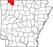
List of lakes of Carroll County, Arkansas
Map all coordinates using OpenStreetMap
Download coordinates as:
- KML
- GPX (all coordinates)
- GPX (primary coordinates)
- GPX (secondary coordinates)
There are at least 10 named lakes and reservoirs in Carroll County, Arkansas.
Lakes
According to the United States Geological Survey, there are no named lakes in Carroll County, Arkansas.
Reservoirs

- Beaver Lake, 36°14′08″N 093°56′34″W / 36.23556°N 93.94278°W / 36.23556; -93.94278 (Beaver Lake), el. 1,122 feet (342 m) [1]
- Brewer Lake, 36°09′06″N 093°19′43″W / 36.15167°N 93.32861°W / 36.15167; -93.32861 (Brewer Lake), el. 2,116 feet (645 m) [2]
- Eureka Springs City Lake, 36°23′34″N 093°44′49″W / 36.39278°N 93.74694°W / 36.39278; -93.74694 (Eureka Springs City Lake), el. 1,227 feet (374 m) [3]
- Farwell Spider Creek Lake, 36°26′25″N 093°50′48″W / 36.44028°N 93.84667°W / 36.44028; -93.84667 (Farwell Spider Creek Lake), el. 955 feet (291 m) [4]
- Fuller Lake, 36°26′21″N 093°35′37″W / 36.43917°N 93.59361°W / 36.43917; -93.59361 (Fuller Lake), el. 974 feet (297 m) [5]
- Jackson Lake, 36°17′36″N 093°30′49″W / 36.29333°N 93.51361°W / 36.29333; -93.51361 (Jackson Lake), el. 1,283 feet (391 m) [6]
- Lake Lucerene, 36°22′24″N 093°42′31″W / 36.37333°N 93.70861°W / 36.37333; -93.70861 (Lake Lucerene), el. 1,411 feet (430 m) [7]
- Lake of No Return, 36°11′24″N 093°22′31″W / 36.19000°N 93.37528°W / 36.19000; -93.37528 (Lake of No Return), el. 1,565 feet (477 m) [8]
- Leatherwood Lake, 36°26′42″N 093°45′01″W / 36.44500°N 93.75028°W / 36.44500; -93.75028 (Leatherwood Lake), el. 1,030 feet (310 m) [9]
- Table Rock Lake, 36°35′44″N 093°18′39″W / 36.59556°N 93.31083°W / 36.59556; -93.31083 (Table Rock Lake), el. 791 feet (241 m) [10]
See also
Notes
- ^ "Beaver Lake". Geographic Names Information System. United States Geological Survey, United States Department of the Interior.
- ^ "Brewer Lake". Geographic Names Information System. United States Geological Survey, United States Department of the Interior.
- ^ "Eureka Springs City Lake". Geographic Names Information System. United States Geological Survey, United States Department of the Interior.
- ^ "Farwell Spider Creek Lake". Geographic Names Information System. United States Geological Survey, United States Department of the Interior.
- ^ "Fuller Lake". Geographic Names Information System. United States Geological Survey, United States Department of the Interior.
- ^ "Jackson Lake". Geographic Names Information System. United States Geological Survey, United States Department of the Interior.
- ^ "Lake Lucerene". Geographic Names Information System. United States Geological Survey, United States Department of the Interior.
- ^ "Lake of No Return". Geographic Names Information System. United States Geological Survey, United States Department of the Interior.
- ^ "Leatherwood Lake". Geographic Names Information System. United States Geological Survey, United States Department of the Interior.
- ^ "Table Rock Lake". Geographic Names Information System. United States Geological Survey, United States Department of the Interior.
- v
- t
- e
Municipalities and communities of Carroll County, Arkansas, United States
County seats: Berryville and Eureka Springs
communities
‡This populated place also has portions in an adjacent county or counties
- Arkansas portal
- United States portal


