List of hospitals in Cameroon
Map all coordinates using OpenStreetMap
Download coordinates as:
- KML
- GPX (all coordinates)
- GPX (primary coordinates)
- GPX (secondary coordinates)
The following is a list of hospitals in Cameroon by region showing the type and location of the hospitals.[1][2]
Large hospitals in Cameroon, such as the 650 bed-Central Hospital of Yaoundé founded in 1933, date from the French and British rule period. The General Hospital in Yaoundé was originally established for blacks only.[3]
Beginning in 2016, Cameroon's health infrastructure was organized into the 10 Regions containing 189 health districts, 1800 health areas managed by the Cameroonian Ministry of Public Health. There are district hospitals in most districts and regional hospitals in all Regions except the East Region. There were approximately 5166 public and private health facilities spread throughout the national territory. Access to health services in Cameroon in 2016 was at 2.19 health facilities per 10,000 inhabitants. Besides public hospitals, there are also non-profit hospitals managed for the most part by religious organizations. There are several hospitals in Cameroon built by or supported by the Chinese Ministry of Health.[4] The health facilities are organized into seven main categories: general hospitals, central hospitals, regional hospitals, district hospitals, district medical centers, Integrated health centers and ambulatory health centers.[5]
Adamawa
The Ministry of Public Health has established nine health districts in the Adamawa Region. There are five district hospitals, one private hospital, and one regional hospital in the Adamawa Region.[6]
| Name | Type | City/Commune, Coords., Refs.[7] |
|---|---|---|
| Bankim Hôpital de District | District, Ministry of Public Health | Bankim, 6°04′42″N 11°29′30″E / 6.0784°N 11.4917°E / 6.0784; 11.4917 (Bankim District Hospital)[2] |
| Banyo Hôpital de District | District, Ministry of Public Health | Banyo, 6°44′43″N 11°47′16″E / 6.7454°N 11.7878°E / 6.7454; 11.7878 (Banyo District Hospital)[2] |
| Baptist Hospital Banyo | Non-profit, Cameroon Baptist Convention Healthcare | Banyo, 6°45′07″N 11°49′51″E / 6.751869113693811°N 11.830960369380644°E / 6.751869113693811; 11.830960369380644 (Baptist Hospital Banyo)[8] |
| Boumdjere Regional Hôpital | Regional, Ministry of Public Health | Boumdjere[2] |
| Belel Centre Médical d'Arrondissement | Centre, Ministry of Public Health | Belel, 7°02′45″N 14°26′08″E / 7.0458°N 14.4356°E / 7.0458; 14.4356 (Belel Medical Centre)[2] |
| Dang Centre Médical d'Arrondissement | Centre, Ministry of Public Health | Dang, 7°25′12″N 13°33′14″E / 7.4201°N 13.5538°E / 7.4201; 13.5538 (Dang Medical Centre)[2] |
| Dibi Centre Médical d'Arrondissement | Centre, Ministry of Public Health | Dibi, 7°08′32″N 13°43′00″E / 7.1421°N 13.7168°E / 7.1421; 13.7168 (Dibi Medical Centre)[2] |
| Dir Centre Médical d'Arrondissement | Centre, Ministry of Public Health | Dir, 6°19′09″N 13°32′39″E / 6.3193°N 13.5443°E / 6.3193; 13.5443 (Dir Medical Centre)[2] |
| Djohong Hôpital de District | District, Ministry of Public Health | Djohong, 6°49′53″N 14°41′40″E / 6.8313°N 14.6945°E / 6.8313; 14.6945 (Djohong District Hospital)[2] |
| Galim-Tignère Centre Médical d'Arrondissement | Centre, Ministry of Public Health | Galim-Tignère, 7°05′54″N 12°27′53″E / 7.0982°N 12.4647°E / 7.0982; 12.4647 (Galim-Tignère Medical Centre)[2] |
| Kontcha Centre Médical d'Arrondissement | Centre, Ministry of Public Health | Kontcha, 7°58′23″N 12°13′38″E / 7.9731°N 12.2272°E / 7.9731; 12.2272 (Kontcha Medical Centre)[2] |
| Mayo-Baléo Centre Médical d'Arrondissement | Centre, Ministry of Public Health | Mayo-Baléo, 7°39′08″N 12°19′51″E / 7.6521°N 12.3308°E / 7.6521; 12.3308 (Mayo-Baléo Medical Centre)[2] |
| Mayo-Darlé Centre Médical d'Arrondissement | Centre, Ministry of Public Health | Mayo-Darlé, 6°30′01″N 11°32′57″E / 6.5002°N 11.5491°E / 6.5002; 11.5491 (Mayo-Darlé Medical Centre)[2] |
| Mbe Centre Médical d'Arrondissement | Centre, Ministry of Public Health | Mbe, 7°51′17″N 13°35′53″E / 7.8547°N 13.5981°E / 7.8547; 13.5981 (Mbe Medical Centre)[2] |
| Meiganga Hôpital de District | District, Ministry of Public Health | Meiganga, 6°30′38″N 14°17′49″E / 6.5106°N 14.2970°E / 6.5106; 14.2970 (Meiganga District Hospital)[2] |
| Ngaoundal Centre Medical d’Arrondissement | Centre, Ministry of Public Health | Ngaoundal, 6°30′00″N 13°16′00″E / 6.5000°N 13.2667°E / 6.5000; 13.2667 (Ngaoundal Medical Centre)[2] |
| Ngaoundere Hôpital Regional | Regional, Ministry of Public Health | Ngaoundéré, 7°18′24″N 13°34′56″E / 7.3067°N 13.5823°E / 7.3067; 13.5823 (Ngaoundere Regional Hospital)[2] |
| Nyambaka Centre Médical d'Arrondissement | Centre, Ministry of Public Health | Nyambaka, 6°53′54″N 14°05′07″E / 6.8983°N 14.0854°E / 6.8983; 14.0854 (Nyambaka Medical Centre)[2] |
| Protestant Hospital of Ngaoundéré | Non-profit, Global Health Ministries | Ngaoundéré, 7°18′34″N 13°35′49″E / 7.309382°N 13.596818°E / 7.309382; 13.596818 (Protestant Hospital of Ngaoundéré)[2] |
| Songkolong Centre Médical d'Arrondissement | Centre, Ministry of Public Health | Songkolong, 6°23′43″N 11°19′24″E / 6.3953°N 11.3233°E / 6.3953; 11.3233 (Songkolong Medical Centre)[2] |
| Tibati Centre Médical d'Arrondissement | Centre, Ministry of Public Health | Tibati, 6°27′47″N 12°37′21″E / 6.4631°N 12.6224°E / 6.4631; 12.6224 (Tibati Medical Centre)[2] |
| Tignère Hôpital de District | District, Ministry of Public Health | Tignère, 7°21′14″N 12°38′59″E / 7.3538°N 12.6497°E / 7.3538; 12.6497 (Tignère District Hospital)[2] |
Centre
The Ministry of Public Health has established 30 health districts in the Centre Region. There are 27 district hospitals, one Central Hospital and University (CHU), and one regional hospital in the Centre Region. The Central Hospital of Yaoundé, founded in 1933, is the largest hospital in Cameroon with 650 beds.[6][3]
| Name | Type | City/Commune, Coords., Refs.[7] |
|---|---|---|
| Akonolinga Hôpital de District | District, Ministry of Public Health | Akonolinga, 3°46′40″N 12°15′21″E / 3.7778°N 12.2559°E / 3.7778; 12.2559 (Akonolnga District Hospital)[2] |
| Awaé Hôpital de District | District, Ministry of Public Health | Awaé, 3°54′14″N 11°52′52″E / 3.9039°N 11.8810°E / 3.9039; 11.8810 (Awaé District Hospital)[2] |
| Ayos Annex Hôpital Regional | Regional, Ministry of Public Health | Ayos, 3°53′51″N 12°31′48″E / 3.8976°N 12.5299°E / 3.8976; 12.5299 (Ayos Annex Regional Hospital)[2] |
| Bafia Hôpital de District | District, Ministry of Public Health | Bafia, 4°44′26″N 11°14′07″E / 4.7406°N 11.2354°E / 4.7406; 11.2354 (Bafia District Hospital)[2] |
| Biyem-Assi Hôpital de District | District, Ministry of Public Health | Yaoundé, 3°49′35″N 11°29′15″E / 3.8263°N 11.4874°E / 3.8263; 11.4874 (Biyem-Assi District Hospital)[2] |
| Cabinet Medicale de La Cathedrale | Private, Catholic Church | Yaoundé, 3°53′03″N 11°32′05″E / 3.8840773062312364°N 11.534819824522462°E / 3.8840773062312364; 11.534819824522462 (Cathederal Medical Center)[9] |
| Central Hospital of Yaoundé | Central, Ministry of Public Health | Yaoundé, 3°52′17″N 11°30′37″E / 3.8714°N 11.5104°E / 3.8714; 11.5104 (Central Hospital Yaounda)[9][1] |
| Centre Hospitalier et Universitaire de Yaoundé | CHU, University of Yaoundé | Yaoundé, 3°51′46″N 11°29′48″E / 3.862676°N 11.496645°E / 3.862676; 11.496645 (CHU Yaoundé)[9] |
| Cite Verte Hôpital de District | District, Ministry of Public Health | Yaoundé, 3°52′15″N 11°29′33″E / 3.8707°N 11.4926°E / 3.8707; 11.4926 (Cite Verte District Hospital)[2] |
| D'joungolo Hôpital de District | District, Ministry of Public Health | Yaoundé, 3°53′06″N 11°31′59″E / 3.8851°N 11.5331°E / 3.8851; 11.5331 (D'Joungolo District Hospital)[2] |
| Ebebda Hôpital de District | District, Ministry of Public Health | Ebebda, 4°21′00″N 11°18′01″E / 4.3499°N 11.3002°E / 4.3499; 11.3002 (Ebebda District Hospital)[2] |
| Efoulan Hôpital de District | District, Ministry of Public Health | Efoulan, 3°49′46″N 11°30′40″E / 3.8295°N 11.5110°E / 3.8295; 11.5110 (Efoulan District Hospital)[2] |
| Elig-Mfomo Hôpital de District | District, Ministry of Public Health | Elig-Mfomo, 4°16′37″N 11°07′12″E / 4.2770°N 11.1201°E / 4.2770; 11.1201 (Elig-Mfomo District Hospital)[2] |
| Eséka Hôpital de District | District, Ministry of Public Health | Eséka, 3°38′22″N 10°46′31″E / 3.6395°N 10.7753°E / 3.6395; 10.7753 (Eséka District Hospital)[2] |
| Esse Hôpital de District | District, Ministry of Public Health | Esse, 4°05′33″N 11°53′07″E / 4.0924°N 11.8852°E / 4.0924; 11.8852 (Esse District Hospital)[2] |
| Essos Centre Hospital | Centre, Ministry of Public Health | Yaoundé, 3°52′26″N 11°32′27″E / 3.8740°N 11.5409°E / 3.8740; 11.5409 (Essos Centre Hospital)[2] |
| Evodoula Hôpital de District | District, Ministry of Public Health | Evodoula, 4°05′32″N 11°12′00″E / 4.0923°N 11.2001°E / 4.0923; 11.2001 (Evodoula District Hospital)[2] |
| Hôpital Général de Yaoundé | General | Yaoundé, 3°54′24″N 11°32′29″E / 3.9066°N 11.5414°E / 3.9066; 11.5414 (Hospital General, Yaoundé)[9][1][2] |
| Institute Pasteur (Ritha Moussongi) | Private, Pasteur Institute | Yaoundé, 3°52′25″N 11°30′40″E / 3.8736939904663146°N 11.511108826781074°E / 3.8736939904663146; 11.511108826781074 (Institute Pasteur)[9] |
| Mbalmayo District Hospital | District, Ministry of Public Health | Mbalmayo, 3°30′52″N 11°30′32″E / 3.5145°N 11.5089°E / 3.5145; 11.5089 (Mbalmayo District Hospital)[2] |
| Mbandjock Hôpital de District | District, Ministry of Public Health | Mbandjock, 4°26′34″N 11°54′28″E / 4.4428°N 11.9079°E / 4.4428; 11.9079 (Mbandjock District Hospital)[2] |
| Mbankomo Hôpital de District | District, Ministry of Public Health | Mbankomo, 3°46′48″N 11°24′00″E / 3.7800°N 11.4000°E / 3.7800; 11.4000 (Mbankomo District Hospital)[2] |
| Mfou Hôpital de District | District, Ministry of Public Health | Mfou, 3°43′02″N 11°38′46″E / 3.7172°N 11.6462°E / 3.7172; 11.6462 (Mfou District Hospital)[2] |
| Monatélé Hôpital de District | District, Ministry of Public Health | Monatélé, 4°15′01″N 11°12′10″E / 4.2502°N 11.2028°E / 4.2502; 11.2028 (Monatélé District Hospital)[2] |
| Nanga Eboko Hôpital de District | District, Ministry of Public Health | Nanga Eboko, 4°39′28″N 12°22′15″E / 4.6578°N 12.3708°E / 4.6578; 12.3708 (Nanga Eboko District Hospital)[2] |
| Ndikiniméki Hôpital de District | District, Ministry of Public Health | Ndikiniméki, 4°45′03″N 10°49′39″E / 4.7508°N 10.8276°E / 4.7508; 10.8276 (Ndikiniméki District Hospital)[2] |
| Ngog-Mapubi Hôpital de District | District, Ministry of Public Health | Ngog-Mapubi, 3°56′33″N 10°50′25″E / 3.9425°N 10.8404°E / 3.9425; 10.8404 (Ngog-Mapubi District Hospital)[2] |
| Ngoumou Hôpital de District | District, Ministry of Public Health | Ngoumou, 3°35′30″N 11°18′26″E / 3.5917°N 11.3072°E / 3.5917; 11.3072 (Ngoumou District Hospital)[2] |
| Nkolndongo District Hospital | District, Ministry of Public Health | Yaoundé, 3°51′19″N 11°32′05″E / 3.8554°N 11.5346°E / 3.8554; 11.5346 (Nkolndongo District Hospital)[2] |
| Ntui Hôpital de District | District, Ministry of Public Health | Ntui, 4°26′11″N 11°37′56″E / 4.4363°N 11.6323°E / 4.4363; 11.6323 (Ntui District Hospital)[2] |
| Obala Hôpital de District | District, Ministry of Public Health | Obala, 4°09′22″N 11°32′16″E / 4.1562°N 11.5378°E / 4.1562; 11.5378 (Obala District Hospital)[2] |
| Olembe Hôpital de District | District, Ministry of Public Health | Olembe, Yaoundé 3°50′33″N 11°33′26″E / 3.8425°N 11.5573°E / 3.8425; 11.5573 (Olembe District Hospital)[2] |
| Sa'a Hôpital de District | District, Ministry of Public Health | Sa'a, 4°21′23″N 11°26′53″E / 4.3564°N 11.4480°E / 4.3564; 11.4480 (Sa'a District Hospital)[2] |
| Soa Hôpital de District | District, Ministry of Public Health | Soa, 3°55′00″N 11°35′05″E / 3.9167°N 11.5846°E / 3.9167; 11.5846 (Soa District Hospital)[2] |
| Yaoundé Gynaecology, Obstetrics and Pediatrics Hospital | Specialist, Chinese Ministry of Health | Yaoundé3°52′31″N 11°31′48″E / 3.875195°N 11.529926°E / 3.875195; 11.529926 (Yaoundé Gynaecology, Ost.. and Ped Hospital)[1][10] |
| Yoko Hôpital de District | District, Ministry of Public Health | Yoko, 5°32′21″N 12°19′13″E / 5.5391°N 12.3203°E / 5.5391; 12.3203 (Yoko District Hospital)[2] |
East
The Ministry of Public Health has established 14 health districts in the East Region. There are 14 district hospitals in the East Region.[6]
| Name | Type | City/Commune, Coords., Refs[7] |
|---|---|---|
| Abong-Mbang Hôpital de District | District, Ministry of Public Health | Abong-Mbang, 3°58′42″N 13°10′55″E / 3.9783°N 13.1820°E / 3.9783; 13.1820 (Abong-Mbang District Hospital)[2] |
| Batouri Hôpital de District | District, Ministry of Public Health | Batouri, 4°26′29″N 14°22′28″E / 4.4413°N 14.3744°E / 4.4413; 14.3744 (Batouri District Hospital)[2] |
| Bertoua Hôpital de District | District, Ministry of Public Health | Bertoua, 4°33′16″N 13°41′00″E / 4.5545°N 13.6834°E / 4.5545; 13.6834 (Bertoua District Hospital)[2] |
| Bétaré-Oya Hôpital de District | District, Ministry of Public Health | Bétaré-Oya, 5°35′18″N 14°05′15″E / 5.5883°N 14.0875°E / 5.5883; 14.0875 (Bétaré-Oya District Hospital)[2] |
| Doume Hôpital de District | District, Ministry of Public Health | Doumé, 4°14′19″N 13°26′27″E / 4.2386°N 13.4408°E / 4.2386; 13.4408 (Doume District Hospital)[2] |
| Garoua Boulai Hôpital de District | District, Ministry of Public Health | Garoua, 5°51′55″N 14°33′24″E / 5.8653°N 14.5566°E / 5.8653; 14.5566 (Garoua Boulai District Hospital)[2] |
| Kette Hôpital de District | District, Ministry of Public Health | Kette, 4°53′00″N 14°32′45″E / 4.8833°N 14.5457°E / 4.8833; 14.5457 (Kette District Hospital)[2] |
| Lomie Hôpital de District | District, Ministry of Public Health | Lomié, 3°09′33″N 13°37′11″E / 3.1593°N 13.6196°E / 3.1593; 13.6196 (Lomie District Hospital)[2] |
| Mbang Hôpital de District | District, Ministry of Public Health | Mbang, 3°57′43″N 14°16′04″E / 3.9619°N 14.2678°E / 3.9619; 14.2678 (Mbang District Hospital)[2] |
| Messamena Hôpital de District | District, Ministry of Public Health | Messamena, 3°43′57″N 12°49′27″E / 3.7325°N 12.8241°E / 3.7325; 12.8241 (Messamena District Hospital)[2] |
| Moloundou Hôpital de District | District, Ministry of Public Health | Moloundou, 2°02′54″N 15°12′55″E / 2.0482°N 15.2152°E / 2.0482; 15.2152 (Moloundou District Hospital)[2] |
| Ndelele Hôpital de District | District, Ministry of Public Health | Ndelele, 4°02′12″N 14°55′47″E / 4.0368°N 14.9297°E / 4.0368; 14.9297 (Ndelele District Hospital)[2] |
| Nguelemendouka Hôpital de District | District, Ministry of Public Health | Nguelemendouka, 4°23′46″N 12°55′31″E / 4.3960°N 12.9253°E / 4.3960; 12.9253 (Nguelemendouka District Hospital)[2] |
| Yokadouma Hôpital de District | District, Ministry of Public Health | Yokadouma, 3°31′04″N 15°02′53″E / 3.5178°N 15.0480°E / 3.5178; 15.0480 (Yokadouma District Hospital)[2] |
Littoral
The Ministry of Public Health has established 24 health districts in the Littoral Region. There are 18 district hospitals in the Littoral Region.[6]
| Name | Type | City/Commune, Coords., Refs.[7] |
|---|---|---|
| Bonamoussadi Ad Lucem Hôpital de District | District, Ministry of Public Health | Douala, 4°05′01″N 9°43′31″E / 4.0836°N 9.7253°E / 4.0836; 9.7253 (Bonamoussadi Ad Lucem District Hospital), [2] |
| Bonassama Hôpital de District | District, Ministry of Public Health | Bonabéri, 4°04′23″N 9°41′08″E / 4.0731380910526065°N 9.685597934818913°E / 4.0731380910526065; 9.685597934818913 (Bonassama District Hospital)[2] |
| Chinese Hospital | General hospital, Chinese Ministry of Health | Douala, 4°03′24″N 9°46′01″E / 4.056546842086936°N 9.767043209179782°E / 4.056546842086936; 9.767043209179782 (Chinese Hospital)[9][10] |
| Cite Des Palmiers Hôpital de District | District, Ministry of Public Health | Douala, 4°02′31″N 9°45′42″E / 4.0420°N 9.7617°E / 4.0420; 9.7617 (Cite Des Palmiers District Hospital)[2] |
| Deido Hôpital de District | District, Ministry of Public Health | Douala, 4°01′44″N 9°40′57″E / 4.0289°N 9.6826°E / 4.0289; 9.6826 (Deido District Hospital)[2] |
| Dibombari Hôpital de District | District, Ministry of Public Health | Dibombari, 4°10′43″N 9°39′22″E / 4.1787°N 9.6561°E / 4.1787; 9.6561 (District Hospital)[2] |
| Douala Hôpital General | General, Ministry of Public Health | Douala, 4°03′17″N 9°45′30″E / 4.0548°N 9.7582°E / 4.0548; 9.7582 (Douala Hospital General)[2] |
| Edéa Hôpital Regional | Regional, Ministry of Public Health | Edéa, 3°47′26″N 10°06′59″E / 3.7905°N 10.1165°E / 3.7905; 10.1165 (Edéa Regional Hospital)[2] |
| Ekol-Mbeng Hôpital Regional | Regional, Ministry of Public Health | Nkongsamba. 4°57′37″N 9°55′51″E / 4.9604°N 9.9307°E / 4.9604; 9.9307 (Ekol-Mben Regional Hospital)[2] |
| Laquintinie Hospital | Ministry of Public Health | Douala, 4°02′55″N 9°42′12″E / 4.048625025497793°N 9.703369882461907°E / 4.048625025497793; 9.703369882461907 (Laquintinie Hospital)[11] |
| Logbaba Hôpital de District | District, Ministry of Public Health | Douala, 4°01′32″N 9°45′15″E / 4.0255°N 9.7542°E / 4.0255; 9.7542 (Logbaba District Hospital)[2] |
| Loum Hôpital de District | District, Ministry of Public Health | Loum, 4°42′56″N 9°43′49″E / 4.7156°N 9.7302°E / 4.7156; 9.7302 (Loum District Hospital)[2] |
| Manjo Hôpital de District | District, Ministry of Public Health | Manjo, 4°50′19″N 9°49′20″E / 4.8386°N 9.8222°E / 4.8386; 9.8222 (Manjo District Hospital)[2] |
| Manoka Hôpital de District | District, Ministry of Public Health | Manoka, 4°01′41″N 9°40′56″E / 4.0281°N 9.6823°E / 4.0281; 9.6823 (Manoka District Hospital)[Note 1][2] |
| Mbanga Hôpital de District | District, Ministry of Public Health | Mbanga, 4°29′16″N 9°33′51″E / 4.4877°N 9.5643°E / 4.4877; 9.5643 (Mbanga District Hospital)[2] |
| Mboppi Baptist Hospital | Non-profit, Cameroon Baptist Convention Healthcare | Douala, 4°02′29″N 9°42′58″E / 4.0412866445764015°N 9.71614190917974°E / 4.0412866445764015; 9.71614190917974 (Mboppi Baptist Hospital)[12] |
| Melong Hôpital de District | District, Ministry of Public Health | Melong, 5°06′44″N 9°56′27″E / 5.1121°N 9.9407°E / 5.1121; 9.9407 (Melong District Hospital)[2] |
| Ndom Hôpital de District | District, Ministry of Public Health | Ndom, 4°23′16″N 10°49′01″E / 4.3877°N 10.8170°E / 4.3877; 10.8170 (Ndom District Hospital)[2] |
| New Bell Hôpital de District | District, Ministry of Public Health | Douala, 4°01′07″N 9°42′35″E / 4.0187°N 9.7097°E / 4.0187; 9.7097 (New Bell District Hospital)[2] |
| Ngambé Hôpital de District | District, Ministry of Public Health | Ngambé, 4°13′49″N 10°37′23″E / 4.2304°N 10.6231°E / 4.2304; 10.6231 (Ngambe District Hospital)[2] |
| Nkondjock Hôpital de District | District, Ministry of Public Health | Sahe, 4°50′24″N 10°13′38″E / 4.8401°N 10.2271°E / 4.8401; 10.2271 (Nkondjock District Hospital)[2] |
| Nylon Hôpital de District | District, Ministry of Public Health | Douala, 4°01′10″N 9°43′50″E / 4.0194°N 9.7306°E / 4.0194; 9.7306 (Nylon District Hospital)[2] |
| Polyclinique Bonanjo Daniel Muna Memorial Clinic | General, Private | Douala, 4°02′14″N 9°41′22″E / 4.037273341314301°N 9.68941773801561°E / 4.037273341314301; 9.68941773801561 (Polyclinique Bonanjo)[9][13] |
| Pouma Hôpital de District | District, Ministry of Public Health | Pouma, 3°50′54″N 10°31′21″E / 3.8482°N 10.5226°E / 3.8482; 10.5226 (Pouma District Hospital)[2] |
| Presbyterian Health Complex Douala | Non-profit Eye Clinic, Presbyterian | Douala, 4°04′26″N 9°43′16″E / 4.074008570037073°N 9.721064777833883°E / 4.074008570037073; 9.721064777833883 (Presbyterian Health Complex)[14] |
| Yabassi Hôpital de District | District, Ministry of Public Health | Yabassi, 4°27′05″N 9°58′15″E / 4.4514°N 9.9708°E / 4.4514; 9.9708 (Yabassi District Hospital)[2] |
North
The Ministry of Health has divided the North Region into 15 health districts. There are two health districts for Garoua. The regional hospital is in Garoua. In addition to the district hospitals listed below, there is a Golombe health district.[6]
| Name | Type | City/Commune, Coords., Refs.[7] |
|---|---|---|
| Bibemi Hôpital de District | District, Ministry of Public Health | Bibemi9°18′31″N 13°52′36″E / 9.3087°N 13.8768°E / 9.3087; 13.8768 (Bibemi District Hospital)[2] |
| Figuil Hôpital de District | District, Ministry of Public Health | Figuil9°45′01″N 13°58′09″E / 9.7502°N 13.9693°E / 9.7502; 13.9693 (Figuil District Hospital)[2] |
| Garoua Hôpital de District | District, Ministry of Public Health | Garoua9°17′58″N 13°23′30″E / 9.2995°N 13.3918°E / 9.2995; 13.3918 (Garoua District Hospital)[2] |
| Garoua Hôpital Regional | Regional, Ministry of Public Health | Garoua, 9°17′44″N 13°23′18″E / 9.2955°N 13.3884°E / 9.2955; 13.3884 (Garoua Regional Hospital)[2] |
| Gaschiga Hôpital de District | District, Ministry of Public Health | Gashiga9°25′59″N 13°21′48″E / 9.4331°N 13.3634°E / 9.4331; 13.3634 (Gaschiga District Hospital)[2] |
| Guider Hôpital de District | District, Ministry of Public Health | Guider9°55′45″N 13°57′03″E / 9.9291°N 13.9508°E / 9.9291; 13.9508 (Guider District Hospital)[2] |
| Lagdo Hôpital de District | District, Ministry of Public Health | Lagdo9°03′06″N 13°39′37″E / 9.0516°N 13.6602°E / 9.0516; 13.6602 (Lagdo District Hospital)[2] |
| M Hôpital de District | District, Ministry of Public Health | Garoua9°17′43″N 13°23′32″E / 9.2953°N 13.3921°E / 9.2953; 13.3921 (Lagdo District Hospital)[2] |
| Mayo-Oulo Hôpital de District | District, Ministry of Public Health | Mayo-Oulo9°58′07″N 13°37′06″E / 9.9686°N 13.6183°E / 9.9686; 13.6183 (Mayo-Oulo District Hospital)[2] |
| Ngong Hôpital de District | District, Ministry of Public Health | Ngong9°01′30″N 13°30′35″E / 9.0251°N 13.5097°E / 9.0251; 13.5097 (Ngong District Hospital)[2] |
| Pitoa Hôpital de District | District, Ministry of Public Health | Pitoa9°23′13″N 13°30′20″E / 9.3869°N 13.5055°E / 9.3869; 13.5055 (Pitoa District Hospital)[2] |
| Poli Hôpital de District | District, Ministry of Public Health | Poli, Faro Department8°28′29″N 13°14′43″E / 8.4748°N 13.2454°E / 8.4748; 13.2454 (Poli District Hospital)[2] |
| Rey Bouba Hôpital de District | District, Ministry of Public Health | Rey Bouba8°39′33″N 14°10′25″E / 8.6591°N 14.1736°E / 8.6591; 14.1736 (Rey Bouba District Hospital)[2] |
| Tcholliré Hôpital de District | District, Ministry of Public Health | Tcholliré8°24′08″N 14°10′11″E / 8.4022°N 14.1698°E / 8.4022; 14.1698 (Tcholliré District Hospital)[2] |
| Touboro Hôpital de District | District, Ministry of Public Health | Touboro7°46′04″N 15°21′21″E / 7.7677°N 15.3558°E / 7.7677; 15.3558 (Touboro District Hospital)[2] |
Extreme North
The Ministry of Public Health has divided the Extreme North Region into 30 health districts. [6]
| Name | Type | City/Commune, Coords., Refs.[7] |
|---|---|---|
| Maroua Hôpital Regional | Regional, Ministry of Public Health | Maroua, 10°35′12″N 14°18′42″E / 10.5868°N 14.3118°E / 10.5868; 14.3118 (Maroua Regional Hospital)[2] |
| Yagoua Hôpital Regional | Regional, Ministry of Public Health | Yagoua, 10°19′05″N 15°13′35″E / 10.3180°N 15.2265°E / 10.3180; 15.2265 (Yagoua Regional Hospital)[2] |
| Annexe de Kousséri Hôpital Regional | Regional, Ministry of Public Health | Kousséri, 12°05′02″N 15°01′57″E / 12.0838°N 15.0326°E / 12.0838; 15.0326 (Kousseri Regional Hospital Annex)[2] |
| Bogo Hôpital de District | District, Ministry of Public Health | Bogo, 10°43′15″N 14°35′41″E / 10.7209°N 14.5947°E / 10.7209; 14.5947 (Bogo District)[2] |
| Bourha Hôpital de District | District, Ministry of Public Health | Bourha, 10°15′13″N 13°30′56″E / 10.2535°N 13.5155°E / 10.2535; 13.5155 (Bourha District Hospital)[2] |
| Doukoula Hôpital de District | District, Ministry of Public Health | Doukoula, 10°06′50″N 14°58′17″E / 10.1138°N 14.9715°E / 10.1138; 14.9715 (Doukoula District Hospital)[2] |
| Goulfey Hôpital de District | District, Ministry of Public Health | Goulfey, 12°22′44″N 14°54′31″E / 12.3788°N 14.9086°E / 12.3788; 14.9086 (Goulfey District)[2] |
| Guere Hôpital de District | District, Ministry of Public Health | Guere, 10°01′23″N 15°16′25″E / 10.0230°N 15.2737°E / 10.0230; 15.2737 (Guere District)[2] |
| Guidiguis Hôpital de District | District, Ministry of Public Health | Guidiguis, 10°08′15″N 14°42′38″E / 10.1375°N 14.7105°E / 10.1375; 14.7105 (Guidiguis District)[2] |
| Hina Hôpital de District | District, Ministry of Public Health | Hina, 10°21′52″N 13°51′20″E / 10.3645°N 13.8555°E / 10.3645; 13.8555 (Hina District)[2] |
| Hôpital Cemao de Meskine | Non-profit, Medical Centres of West Africa | Miskine, 10°33′52″N 14°15′06″E / 10.564373758382711°N 14.251561023272144°E / 10.564373758382711; 14.251561023272144 (Hospital Cemao Meskine)[9][15] |
| Kaélé Hôpital de District | District, Ministry of Public Health | Kaélé, 10°06′24″N 14°26′27″E / 10.1067°N 14.4408°E / 10.1067; 14.4408 (Kaélé District)[2] |
| Kar Hay Hôpital de District | District, Ministry of Public Health | Kar Hay, 10°06′15″N 14°58′30″E / 10.1041°N 14.9750°E / 10.1041; 14.9750 (Kar Hay District Hospital)[2] |
| Kousséri Hôpital de District | District, Ministry of Public Health | Kousséri, 12°04′37″N 15°01′50″E / 12.0769°N 15.0306°E / 12.0769; 15.0306 (Kousséri District)[2] |
| Mada Hôpital de District | District, Ministry of Public Health | Maɗa, 12°37′54″N 14°28′34″E / 12.6318°N 14.4761°E / 12.6318; 14.4761 (Mada District Hospital)[2] |
| Makary Hôpital de District | District, Ministry of Public Health | Makary, 12°34′24″N 14°27′17″E / 12.5734°N 14.4548°E / 12.5734; 14.4548 (Makary District)[2] |
| Mindif Hôpital de District | District, Ministry of Public Health | Mindif, 10°24′04″N 14°26′16″E / 10.4011°N 14.4377°E / 10.4011; 14.4377 (Mindif District)[2] |
| Mogode Hôpital de District | District, Ministry of Public Health | Mogode, 10°35′59″N 13°34′21″E / 10.5996°N 13.5724°E / 10.5996; 13.5724 (Mogode District)[2] |
| Mokolo Hôpital de District | District, Ministry of Public Health | Mokolo, 10°44′38″N 13°48′05″E / 10.7438°N 13.8014°E / 10.7438; 13.8014 (Mokolo District)[2] |
| Mora Hôpital de District | District, Ministry of Public Health | Mora, 11°02′33″N 14°08′40″E / 11.0425°N 14.1444°E / 11.0425; 14.1444 (Mora District)[2] |
| Moulvoudaye Hôpital de District | District, Ministry of Public Health | Moulvoudaye, 10°23′51″N 14°51′25″E / 10.3976°N 14.8570°E / 10.3976; 14.8570 (Moulvoudaye District)[2] |
| Moutourwa Hôpital de District | District, Ministry of Public Health | Moutourwa, 10°11′58″N 14°10′51″E / 10.1994°N 14.1807°E / 10.1994; 14.1807 (Moutourwa District)[2] |
| Petté Hôpital de District | District, Ministry of Public Health | Petté, 10°58′08″N 14°29′53″E / 10.9688°N 14.4980°E / 10.9688; 14.4980 (Petté District)[2] |
| Roua Hôpital de District | District, Ministry of Public Health | Roua, 10°46′33″N 13°59′52″E / 10.7759°N 13.9979°E / 10.7759; 13.9979 (Roua District)[2] |
| Tokombéré Hôpital de District | District, Ministry of Public Health | Tokombéré, 10°51′43″N 14°09′31″E / 10.8620°N 14.1587°E / 10.8620; 14.1587 (Tokombéré District)[2] |
| Vele Hôpital de District | District, Ministry of Public Health | Vele, 10°29′09″N 15°12′23″E / 10.4857°N 15.2063°E / 10.4857; 15.2063 (Vele District)[2] |
Northwest
The Ministry of Public Health has divided the Northwest Region into 19 health districts.[6]
| Name | Type | city/Commune, Coords., Refs.[7] | |||
|---|---|---|---|---|---|
| Ako Hôpital de District | District, Ministry of Public Health | Ako[2] | |||
| Bafut Hôpital de District | District, Ministry of Health | Bafut[2] | |||
| Bali Hôpital de District | District, Ministry of Public Health | Bali[2] | |||
| Bamenda Regional Hospital | Regional, Ministry of Health | Bamenda, 5°57′04″N 10°08′30″E / 5.9511°N 10.1418°E / 5.9511; 10.1418 (Bamenda Regional Hospital)[16][2] | |||
| Baptist Hospital Banso | Non-profit, Cameroon Baptist Convention Healthcare | Banso[9][17] | Batibo Hôpital de District | District, Ministry of Public Health | Batibo[2] |
| Bawock Health District Hospital | District, Ministry of Public Health | Bawock | |||
| Benakuma District Hospital | District, Ministry of Publilc Health | Benakuma[2] | |||
| Dunger Baptist Hospital | Non-profit, Cameroon Baptist Convention Healthcare | Mwa, Donga-Mantung | |||
| Fundong Hôpital de District | District, Ministry of Public Health | Fundong[2] | |||
| Grace Gardens Hospital Ndop | Non-profit, Faith Gardens Medical Foundation | Ndop[18] | |||
| Mbengwi Hôpital de District | District, Ministry of Public Health | Mbengwi[2] | |||
| Mbingo Baptist Hospital | Non-profit, Cameroon Baptist Convention Healthcare | Mbingo[9][19] | |||
| Ndop Hôpital de District | District, Ministry of Public Health | Ndop[2] | |||
| Ndu District Hospital | District, Ministry of Public Health | Ndu[2] | |||
| Nduh Hôpital de District | District, Ministry of Public Health | Nduh, Cameroon[2] | |||
| Njikwa Hôpital de District | District, Ministry of Public Health | Fuanatui[2] | |||
| Nkambé Hôpital de District | District, Ministry of Public Health | Nkambé[2] | |||
| Nwa Hôpital de District | District, Ministry of Public Health | Nwa, Donga-Mantung[2] | |||
| Oku Hôpital de District | District, Ministry of Public Health | Oku[2] | |||
| PMI Medicalized Health Center Nkwen | Health Center, Ministry of Public Health | Bamenda[20] | |||
| Presbyterian General Hospital Acha-Tugi | Non-profit, Presbyterian | Acha-Tugi, Momo Department[14] | |||
| Presbyterian Health Centre Bafut | Non-profit, Presbyterian | Bafut[14] | |||
| Santa Hôpital de District | District, Ministry of Public Health | Santa | |||
| St. Elizabeth Catholic General Hospital Shisong | Non-profit, Catholic | Kumbo[21] | |||
| St Martin de porress Catholic General hospital | Non-profit, Catholic | Njinikom | |||
| Tubah Hôpital de District | District, Ministry of Public Health | Bambili, Bamenda[2] | |||
| Wum Hôpital de District | District, Ministry of Public Health | Wum[2] | |||
| Yang Health Center | Ministry of public health | Yang |
South
There are 10 Ministry of Public Health districts in the South Region.[6]
| Name | Type | City/Commune, Coords., Refs.[7] |
|---|---|---|
| Ambam Hôpital de District | District, Ministry of Public Health | Ambam[2] |
| Djoum Hôpital de District | District, Ministry of Public Health | Djoum[2] |
| Ebolowa Regional Hospital | Regional, Ministry of Public Health | Ebolowa, 2°55′12″N 11°10′02″E / 2.9199°N 11.1671°E / 2.9199; 11.1671 (Ebolowa Regional Hospital)[2] |
| Enongal Hôpital Central | Central, Ministry of Public Health | Ebolowa[2] |
| Kribi Hôpital de District | District, Ministry of Public Health | Kribi[2] |
| Lolodorf Hôpital de District | District, Ministry of Public Health | Lolodorf[2] |
| Mekomengona District Hôpital de District | District, Ministry of Public Health | Ebengon, Dja-et-Lobo[2] |
| Meyomessala Hôpital de District | District, Ministry of Public Health | Meyomessala[2] |
| Mvangan Hôpital de District | District, Ministry of Public Health | Mvangane[2] |
| Olamze Hôpital de District | District, Ministry of Public Health | Olamze[2] |
| Sangmélima Hôpital de District | District, Ministry of Public Health | Sangmélima[2] |
| Zoetele Hôpital de District | District, Ministry of Public Health | Zoetele[2] |
Southwest
There are 14 Ministry of Public Health districts in the Southwest Region.[6]
| Name | Type | City/Commune, Coords., Refs.[7] |
|---|---|---|
| Baptist Hospital Mutengene | Non-profit, Cameroon Baptist Convention Health Services | Mutengene[22][23] |
| Buea Regional Hospital | Regional, Ministry of Public Health | Buea, 4°08′45″N 9°13′55″E / 4.1457°N 9.2320°E / 4.1457; 9.2320 (Buea Regional Hospital)[2][10] |
| Christ Medical Center | ||
| Ejed Medical Foundation Hospital | Non-profit | Kumba |
| Hope Clinic | Non-profit | Kosala Kumba |
| Kumba District Hospital | District, Ministry of Public Health | Kumba[2] |
| Limbe Regional Hospital | Regional, Ministry of Public Health | Limbe, 4°01′19″N 9°13′07″E / 4.0219°N 9.2186°E / 4.0219; 9.2186 (Limbe Regional Hospital)[24][2] |
| Mamfe Hôpital de District | District, Ministry of Public Health | Mamfe[2] |
| Mary Health of Africa | Non-profit | Fontem |
| Mbonge Hôpital de District | District, Ministry of Public Health | Mbonge[2] |
| Presbyterian Medical Institutions Manyemen | Non-profit, Presbyterian | Manyemen[14] |
| Mundemba Hôpital de District | District, Ministry of Public Health | Mundemba[2] |
| Muyuka Hôpital de District | District, Ministry of Public Health | Muyuka[2] |
| Presbyterian Health Complex, Kumba | Non-profit, Presbyterian | Kumba[14] |
| Presbyterian Hospital Nyasoso | Non-profit, Presbyterian | Nyasoso[14] |
| Redemption Medical Foundation | Non-profit | Yoke, Muyuka |
| Solidarity Clinic | Non-profit, Solidarity Foundation | Buea |
| St. John of God Hospital | Non-profit | Nguti, Koupé-Manengouba |
| St Joseph's Medical Center | Non-profit | Yoke, Muyuka |
| Subdivisional Hospital | Muea, Buea | |
| Tiko Hôpital de District | District, Ministry of Public Health | Tiko[2] |
| Tombel Hôpital de District | District, Ministry of Public Health | Tombel[2] |
West
There are 20 Ministry of Public Health districts in the West Region.[6]
| Name | Type | City/Commune, Coords., Refs.[7] |
|---|---|---|
| ACHA Foundation Clinic of Bafoussam | Non-profit, ACHA | Bafoussam |
| Bafoussam Baptist Hospital | Non-profit, Cameroon Baptist Convention Healthcare | Bafoussam |
| Bafoussam Regional Hospital | Regional, Ministry of Public Health | Bafoussam, 5°29′12″N 10°24′22″E / 5.4868°N 10.4061°E / 5.4868; 10.4061 (Bafoussam Regional Hospital)[2] |
| Hôpital de District de Bafang | District, Ministry of Public Health | Bafang[2] |
| Hôpital de District de Bandja | District, Ministry of Public Health | Bandja[2] |
| Hôpital de District de Bamendjou | District, Ministry of Public Health | Bamendjou[2] |
| Hôpital de District de Bangangté | District, Ministry of Public Health | Bangangté[2] |
| Hôpital de District de Bandjoun | District, Ministry of Public Health | Bandjoun[2] |
| Hôpital de District de Bangourain | District, Ministry of Public Health | Bangourain[2] |
| Hôpital de District de Batcham | District, Ministry of Public Health | Batcham[2] |
| Hôpital de District de Dschang | District, Ministry of Public Health | Dschang[2] |
| Hôpital de District de Foumban | District, Ministry of Public Health | Foumban[2] |
| Hôpital de District de Foumbot | District, Ministry of Public Health | Foumbot[2] |
| Hôpital de District de Galim | District, Ministry of Public Health | Galim[2] |
| Hôpital de District de Kékem | District, Ministry of Public Health | Kékem[2] |
| Hôpital de District de Kouoptamo | District, Ministry of Public Health | Kouoptamo[2] |
| Hôpital de District de Malantouen | District, Ministry of Public Health | Malantouen[2] |
| Hôpital de District de Massangam | District, Ministry of Public Health | Massangam[2] |
| Hôpital de District de Mbouda | District, Ministry of Public Health | Mbouda[2] |
| Hôpital de District de Penka Michel | District, Ministry of Public Health | Penka[2] |
| Hôpital de District de Santchou | District, Ministry of Public Health | Santchou[2] |
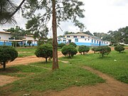
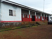
Gallery
Hospitals in Cameroon
-
 CHU Yaounde, Centre Region
 -
 Akonolinga District Hospital, Centre Region
 -
 Protestant Hospital of Ngaoundéré, Adamawa Region
 -
 Laquintinie Hospital, Douala, Littoral Region
 -
 Former Hospital General, Douala, Littoral Region
 -
 Hospital in Koutaba/Kounja, West Region


Notes
References
- ^ a b c d "Annual Medical Directory of Cameroon". Annuaire Medical. Archived from the original on January 25, 2021. Retrieved May 22, 2021.
- ^ a b c d e f g h i j k l m n o p q r s t u v w x y z aa ab ac ad ae af ag ah ai aj ak al am an ao ap aq ar as at au av aw ax ay az ba bb bc bd be bf bg bh bi bj bk bl bm bn bo bp bq br bs bt bu bv bw bx by bz ca cb cc cd ce cf cg ch ci cj ck cl cm cn co cp cq cr cs ct cu cv cw cx cy cz da db dc dd de df dg dh di dj dk dl dm dn do dp dq dr ds dt du dv dw dx dy dz ea eb ec ed ee ef eg eh ei ej ek el em en eo ep eq er es et eu ev ew ex ey ez fa fb fc fd fe ff fg fh fi fj fk fl fm fn fo fp fq fr fs ft fu fv fw fx fy fz ga gb gc gd "A spatial database of health facilities managed by the public health sector in sub-Saharan Africa". World Health Organization. February 11, 2019. Archived from the original on April 22, 2019. Retrieved May 8, 2020.
- ^ a b DeLancey, Mark D.; Mbuh, Rebecca Neh (30 April 2010). Historical Dictionary of the Republic of Cameroon. Scarecrow Press. p. 360. ISBN 978-0-8108-5824-4. Archived from the original on 27 June 2014. Retrieved 25 July 2012.
- ^ MINSANTE, Cameroon Health Map 2016.
- ^ Cameroon: Health Analytical Profile 2016
- ^ a b c d e f g h i j "Public Healthcare by Region Portal". Cameroonian Ministry of Public Health. Archived from the original on May 24, 2021. Retrieved May 24, 2021.
- ^ a b c d e f g h i j Coordinates are derived from Google Maps, Google Earth, or GEONAMES as referenced in the WHO database
- ^ "Baptist Hospital Banyo". www.cbchealthservices.org. Archived from the original on 2019-05-25. Retrieved 2018-08-20.
- ^ a b c d e f g h i j "Physicians in Cameroon" (PDF). US Embassy, Cameroon. Archived (PDF) from the original on March 22, 2021. Retrieved May 22, 2021.
- ^ a b c HILAIRE DE PRINCE POKAM. "Chinese Medicine in Cameroon". China Perspectives. Archived from the original on May 27, 2021. Retrieved May 25, 2021.
- ^ "Hôpital Laquintinie". doualart.org. Archived from the original on 2016-10-30. Retrieved 2021-05-26.
- ^ "Mboppi Baptist Hospital". Cameroon Baptist Convention Healthcare. Archived from the original on May 22, 2021. Retrieved May 26, 2021.
- ^ "Daniel Muna Memorial Clinic". Polyclinique Bonanjo. Archived from the original on May 25, 2021. Retrieved May 25, 2021.
- ^ a b c d e f "Presbyterian Health Units in Cameroon". Presbyterian Church in Cameroon. Archived from the original on September 19, 2020. Retrieved May 26, 2021.
- ^ "Hospital Meskine". Electives.net. Archived from the original on May 24, 2021. Retrieved May 24, 2021.
- ^ "Bamenda Regional Hospital". Archived from the original on 2011-08-07. Retrieved November 1, 2011.,
- ^ "Banso Baptist Hospital". Cameroon Baptist Convention Healthcare. Archived from the original on May 22, 2021. Retrieved May 26, 2021.
- ^ "About Us". Grace Gardens Hospital. Archived from the original on May 26, 2021. Retrieved May 26, 2021.
- ^ "Mbingo Baptist Hospital". Cameroon Baptist Convention Health Services. Archived from the original on May 22, 2021. Retrieved May 25, 2021.
- ^ Nkfusai, C. N.; Cumber, S. N.; Bede, F.; Tambe, T. A.; Tsoka-Gwegweni, J. M. (2019). "Assessment of the knowledge of the modes of transmission and prevention of malaria among pregnant women attending antenatal clinic at the Nkwen Health Center Bamenda, Cameroon". The Pan African Medical Journal. 33: 137. doi:10.11604/pamj.2019.33.137.16896. PMC 6754843. PMID 31558935.
- ^ Giamberti, Alessandro; Butera, Gianfranco; Mve Mvondo, Charles; Cirri, Silvia; Varrica, Alessandro; Moussaidi, Nadia; Isgrò, Giuseppe; Ambassa, Jean Claude; Tantchou, Cabral; Giamberti, Giovanni; Frigiola, Alessandro (2018). "The Shisong Cardiac Center in Cameroon: An Example of a Long-Term Collaboration, Cooperation Toward Autonomy". Frontiers in Pediatrics. 6: 188. doi:10.3389/fped.2018.00188. PMC 6038727. PMID 30018948.
- ^ "Baptist Hospital Mutengene". University of Alabama at Birmingham. Archived from the original on May 26, 2021. Retrieved May 26, 2021.
- ^ "Baptist Hospital Mutengene". Cameroon Baptist Convention Health Serivices. Archived from the original on May 22, 2021. Retrieved May 26, 2021.
- ^ Tim Mbom, Francis (January 31, 2006). "Limbe Rotary Club Donates Hospital, Educational Equipment". Postnewsline.com. Archived from the original on September 27, 2011. Retrieved November 27, 2011.
- "Healthcare Facilities in Cameroon" (PDF). World Health Organization. 2013. Retrieved May 26, 2021.
- v
- t
- e
- Algeria
- Angola
- Benin
- Botswana
- Burkina Faso
- Burundi
- Cameroon
- Cape Verde
- Central African Republic
- Chad
- Comoros
- Democratic Republic of the Congo
- Republic of the Congo
- Djibouti
- Egypt
- Equatorial Guinea
- Eritrea
- Eswatini
- Ethiopia
- Gabon
- The Gambia
- Ghana
- Guinea
- Guinea-Bissau
- Ivory Coast
- Kenya
- Lesotho
- Liberia
- Libya
- Madagascar
- Malawi
- Mali
- Mauritania
- Mauritius
- Morocco
- Mozambique
- Namibia
- Niger
- Nigeria
- Rwanda
- São Tomé and Príncipe
- Senegal
- Seychelles
- Sierra Leone
- Somalia
- South Africa
- South Sudan
- Sudan
- Tanzania
- Togo
- Tunisia
- Uganda
- Zambia
- Zimbabwe
States with limited
recognition
recognition
Dependencies and
other territories
other territories
- Canary Islands / Ceuta / Melilla (Spain)
- Madeira (Portugal)
- Mayotte / Réunion (France)
- Saint Helena / Ascension Island / Tristan da Cunha (United Kingdom)


