List of National Natural Landmarks in Alabama
Map all coordinates using OpenStreetMap
Download coordinates as:
- KML
- GPX (all coordinates)
- GPX (primary coordinates)
- GPX (secondary coordinates)
There are seven National Natural Landmarks in the U.S. state of Alabama.

Beaver Creek Swamp
Dismals Canyon
Shelta Cave
class=notpageimage|
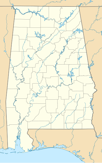
Alabama National Natural Landmarks (clickable map)| Name | Image | Date | Location | County | Ownership | Description | |
|---|---|---|---|---|---|---|---|
| 1 | Beaverdam Creek Swamp | May 1974 | Madison 34°37′30″N 86°49′37″W / 34.62500°N 86.82694°W / 34.62500; -86.82694 (Beaver Creek Swamp) | Limestone | Federal (Wheeler National Wildlife Refuge) | A tupelo gum swamp in an unusual inland location. | |
| 2 | Cathedral Caverns |  | June 1972 | Grant 34°34′24″N 86°13′20″W / 34.57333°N 86.22222°W / 34.57333; -86.22222 (Cathedral Caverns) | Jackson | State | A 11,000 feet (3,400 m) long cave which includes Goliath, a 45 feet (14 m) stalagmite. |
| 3 | Dismals Canyon |  | May 1974 | Hackleburg 34°19′31″N 87°46′54″W / 34.32528°N 87.78167°W / 34.32528; -87.78167 (Dismals Canyon) | Franklin | Private | This sandstone gorge is one of few places worldwide where the dismalites (Orfelia fultoni) gather. Their bioluminescent glow can be seen on night tours in this 85-acre (340,000 m2) natural conservatory. |
| 4 | Mobile Tensaw River Bottom Lands |  | May 1974 | Spanish Fort 30°45′15″N 87°56′32″W / 30.75417°N 87.94222°W / 30.75417; -87.94222 (Mobile Tensaw River Bottom Lands) | Baldwin, Mobile, and Washington | Mixed- federal, state, & private | The second largest river delta in the US, this 260,000-acre (1,100 km2) site has a wide range of habitats and wildlife. The 200-mile (320 km) Bartam Canoe Trail goes through the delta. |
| 5 | Newsome Sinks Karst Area |  | November 1973 | Union Hill 34°26′27″N 86°35′50″W / 34.44083°N 86.59722°W / 34.44083; -86.59722 (Newsome Sinks Karst Area) | Morgan | Private | An area hollowed out by more than 40 caves, with over 50,000 feet (15,000 m) of known passages. |
| 6 | Red Mountain Expressway Cut |  | November 1987 | Birmingham 33°29′44″N 86°47′18″W / 33.49556°N 86.78833°W / 33.49556; -86.78833 (Red Mountain Expressway Cut) | Jefferson | Municipal (City of Birmingham) | Part of Red Mountain Park, this expressway cut through Red Mountain and exposes a rich view into geological history. |
| 7 | Shelta Cave |  | October 1971 | Huntsville 34°45′13″N 86°36′38″W / 34.75361°N 86.61056°W / 34.75361; -86.61056 (Shelta Cave) | Madison | Private | This cave was a dance hall before it became the home of the National Speleological Society There are over nine species of cave dwelling animals that were first discovered here. |
See also
External links
- National Natural Landmarks in Alabama
- Landmarks in Alabama
- v
- t
- e
National Natural Landmarks in the United States
- Alabama
- Alaska
- Arizona
- Arkansas
- California
- Colorado
- Connecticut
- Delaware
- Florida
- Georgia
- Hawaii
- Idaho
- Illinois
- Indiana
- Iowa
- Kansas
- Kentucky
- Louisiana
- Maine
- Maryland
- Massachusetts
- Michigan
- Minnesota
- Mississippi
- Missouri
- Montana
- Nebraska
- Nevada
- New Hampshire
- New Jersey
- New Mexico
- New York
- North Carolina
- North Dakota
- Ohio
- Oklahoma
- Oregon
- Pennsylvania
- Rhode Island
- South Carolina
- South Dakota
- Tennessee
- Texas
- Utah
- Vermont
- Virginia
- Washington
- West Virginia
- Wisconsin
- Wyoming


