Kirkella
Place in Manitoba, Canada
50°01′26″N 101°21′55″W / 50.02389°N 101.36528°W / 50.02389; -101.36528 Canada
 Manitoba
R0M 1A0
Kirkella is an unincorporated hamlet in southwestern Manitoba, Canada. The community was founded on the main line of the Canadian Pacific Railway in 1898. Kirkella was the name of the farm of local pioneer Thomas Watson, which in turn derived its name from Kirk Ella, a village in the East Riding of Yorkshire, England.[2]
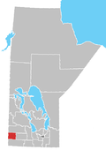
It is located in the Rural Municipality of Wallace, approximately 103 kilometers (64 miles) west of Brandon.[3]
References
- ^ "Population and dwelling counts, for Canada and census subdivisions (municipalities), 2006 and 2001 censuses - 100% data". Statistics Canada, 2006 Census of Population. November 5, 2008. Retrieved January 30, 2009.
- ^ Penny Ham, Place Names of Manitoba, (Saskatoon, Saskatchewan: Western Producer Prairie Books, 1980), 72
- ^ "Geographical Names of Canada - Querying Distances". nrcan.gc.ca. October 24, 2011. Archived from the original on April 7, 2013. Retrieved February 7, 2013.
- v
- t
- e
| Former villages |
|---|
| Former RMs |
|---|
50°01′26″N 101°21′55″W / 50.02389°N 101.36528°W / 50.02389; -101.36528
 | This Manitoba location article is a stub. You can help Wikipedia by expanding it. |
- v
- t
- e


