Khaf County
County in Razavi Khorasan Province, Iran
You can help expand this article with text translated from the corresponding article in Persian. (November 2010) Click [show] for important translation instructions.
- View a machine-translated version of the Persian article.
- Machine translation, like DeepL or Google Translate, is a useful starting point for translations, but translators must revise errors as necessary and confirm that the translation is accurate, rather than simply copy-pasting machine-translated text into the English Wikipedia.
- Do not translate text that appears unreliable or low-quality. If possible, verify the text with references provided in the foreign-language article.
- You must provide copyright attribution in the edit summary accompanying your translation by providing an interlanguage link to the source of your translation. A model attribution edit summary is
Content in this edit is translated from the existing Persian Wikipedia article at [[:fa:شهرستان خواف]]; see its history for attribution. - You may also add the template
{{Translated|fa|شهرستان خواف}}to the talk page. - For more guidance, see Wikipedia:Translation.
County in Razavi Khorasan, Iran
Khaf County Persian: شهرستان خواف | |
|---|---|
County | |
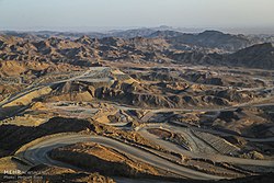 Iron quarry, Sangan | |
 Location of Khaf County in Razavi Khorasan Province (bottom right, yellow) | |
 Location of Razavi Khorasan Province in Iran | |
| Coordinates: 34°26′N 60°09′E / 34.433°N 60.150°E / 34.433; 60.150[1] | |
| Country |  Iran Iran |
| Province | Razavi Khorasan |
| Capital | Khaf |
| Districts | Central, Jolgeh Zuzan, Salami, Sangan |
| Area | |
| • Total | 9,827 km2 (3,794 sq mi) |
| Population (2016)[2] | |
| • Total | 138,972 |
| • Density | 14/km2 (37/sq mi) |
| Time zone | UTC+3:30 (IRST) |
| Khaf County at GEOnet Names Server | |
Khaf County (Persian: شهرستان خواف)[a] is in Razavi Khorasan Province, Iran. Its capital is the city of Khaf.[3]
History
After the 2016 National Census, the village of Sedeh was elevated to the status of a city.[4]
Demographics
Population
At the time of the 2006 census, the county's population was 108,964 in 23,896 households.[5] The following census in 2011 counted 121,859 people in 29,923 households.[6] The 2016 census measured the population of the county as 138,972 in 36,399 households.[2]
Administrative divisions
Khaf County's population history and administrative structure over three consecutive censuses are shown in the following table.
| Administrative Divisions | 2006[5] | 2011[6] | 2016[2] |
|---|---|---|---|
| Central District | 40,652 | 46,273 | 52,899 |
| Miyan Khaf RD | 11,135 | 8,537 | 8,782 |
| Nashtifan RD | 1,810 | 1,866 | 1,752 |
| Khaf (city) | 21,160 | 28,444 | 33,189 |
| Nashtifan (city) | 6,547 | 7,426 | 9,176 |
| Jolgeh Zuzan District | 18,928 | 19,523 | 22,062 |
| Keybar RD | 8,934 | 8,548 | 9,915 |
| Zuzan RD | 5,972 | 6,561 | 7,002 |
| Qasemabad (city) | 4,022 | 4,414 | 5,145 |
| Salami District | 29,658 | 33,867 | 37,447 |
| Bala Khaf RD | 16,278 | 18,842 | 20,394 |
| Salami RD | 7,324 | 8,444 | 9,498 |
| Salami (city) | 6,056 | 6,581 | 7,555 |
| Sedeh (city)[b] | |||
| Sangan District | 19,726 | 22,196 | 26,564 |
| Bostan RD | 7,316 | 8,248 | 9,344 |
| Pain Khaf RD | 3,692 | 4,448 | 4,777 |
| Sangan (city) | 8,718 | 9,500 | 12,443 |
| Total | 108,964 | 121,859 | 138,972 |
| RD = Rural District | |||
Archaeology
The historical city of Zuzan is located close to Khaf and has been submitted to World Heritage tentative lists by UNESCO.[7]
See also
![]() Media related to Khaf County at Wikimedia Commons
Media related to Khaf County at Wikimedia Commons
 Iran portal
Notes
References
- ^ OpenStreetMap contributors (1 May 2023). "Khaf County" (Map). OpenStreetMap (in Persian). Retrieved 1 May 2023.
- ^ a b c "Census of the Islamic Republic of Iran, 1395 (2016)". AMAR (in Persian). The Statistical Center of Iran. p. 09. Archived from the original (Excel) on 2 April 2022. Retrieved 19 December 2022.
- ^ Habibi, Hassan (21 June 1369). "Approval of the organization and chain of citizenship of the elements and units of the divisions of Khorasan province, centered in Mashhad". Islamic Parliament Research Center (in Persian). Ministry of Interior, Defense Political Commission of the Government Board. Archived from the original on 17 November 2015. Retrieved 6 January 2024.
- ^ a b Jahangiri, Ishaq (22 February 1400). "Letter of approval regarding the conversion of the village of Sedeh village of Bala Khaf Rural District, Salami District of Khaf County, Khorasan Razavi province, into a city". Laws and Regulations Portal of the Islamic Republic of Iran (in Persian). Ministry of Interior, Council of Ministers. Archived from the original on 7 January 2024. Retrieved 7 January 2024.
- ^ a b "Census of the Islamic Republic of Iran, 1385 (2006)". AMAR (in Persian). The Statistical Center of Iran. p. 09. Archived from the original (Excel) on 20 September 2011. Retrieved 25 September 2022.
- ^ a b "Census of the Islamic Republic of Iran, 1390 (2011)". Syracuse University (in Persian). The Statistical Center of Iran. p. 09. Archived from the original (Excel) on 20 January 2023. Retrieved 19 December 2022.
- ^ "Zosan". World Heritage Convention: Tentative Lists. UNESCO. 9 August 2007. Retrieved 6 December 2022.
...the authenticity and integrity of the works over there have been nicely kept.
- v
- t
- e

- Abbasabad Complex
- Tomb of Abdolabad
- Aliabad Tower
- Amin al-tojar Caravansarai
- Atashgah Manmade-Cave
- Atashgah Castle
- Firuzabad area
- Firuzabad Tower
- Goharshad Mosque
- Haj Soltan Religious School
- Haji Jalal Mosque
- Haruniyeh Dome
- Imam Reza shrine
- Imamzadeh Hamzeh, Kashmar
- Imamzadeh Seyed Morteza
- Jameh Mosque of Kashmar
- Jameh Mosque of Marandiz
- Jameh Mosque of Nishapur
- Jameh Mosque of Sabzevar
- Karat Minaret
- Khosrogerd Minaret
- Kondor Ab anbars
- Kūh-e Tīr Māhī
- Mausoleum of Attar of Nishapur
- Mausoleum of Omar Khayyám
- Khalilabad Hot Spring
- Pamenar Mosque, Sabzevar
- Qanats of Ghasabeh
- Ribat of Kabudan
- Ribat of Sharaf
- Rig castle
- Shahi Dam
- Sheikh Ahmad-e Jami mausoleum complex
- Seyyed Bagher Ab anbar
- Shadiyakh
- Sir Cave
- Tandooreh National Park
- Tomb of Baba Loghman
- Tomb of Boghrat
- Tomb of Ferdowsi
- Tomb of Hadi Sabzevari
- Tomb of Hassan Modarres
- Tomb of Heydar Yaghma
- Tomb of Kamal-ol-molk
- Tomb of Khajeh Rabie
- Tomb of Nader Shah
- Qal'eh Dokhtar, Kuhsorkh
| |||||||||||||||||||||||||||||||||||||||||
|---|---|---|---|---|---|---|---|---|---|---|---|---|---|---|---|---|---|---|---|---|---|---|---|---|---|---|---|---|---|---|---|---|---|---|---|---|---|---|---|---|---|
| Capital | |||||||||||||||||||||||||||||||||||||||||
| Districts |
| ||||||||||||||||||||||||||||||||||||||||


