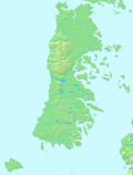
Gulf of Ancud

Gulf of Ancud (Spanish: Golfo de Ancud) is a large body of water separating the Chiloé Island from the mainland of Chile. It is located north of the Gulf of Corcovado by which it is separated by Desertores Islands. To north Calbuco Archipelago separates it from Reloncaví Sound.
External links
- Satellite map of Golfo de Ancud
- v
- t
- e
- Butachauques
- Caucahue
- Chiloé
- Coldita
- Desertores1
- Guafo
- Laitec
- Lemuy
- Quinchao
- San Pedro
- Tranqui

- Gulf of Ancud
- Estero de Castro
- Caulín Bay
- Chacao Channel
- Sea of Chiloé
- Gulf of Corcovado
- Dalcahue Channel
- Caleta Zorra
| Clothing | |
|---|---|
| Architecture and art | |
| Cuisine | |
| Mythology |
1: These islands are not part of Chiloé Province
42°06′S 73°00′W / 42.1°S 73.0°W / -42.1; -73.0
 | This Los Lagos Region location article is a stub. You can help Wikipedia by expanding it. |
- v
- t
- e


