Goodooga, New South Wales
Town in New South Wales, Australia
29°06′0″S 147°28′0″E / 29.10000°S 147.46667°E / -29.10000; 147.46667
- 784 km (487 mi) NW of Sydney
- 714 km (444 mi) SW of Brisbane
- 282 km (175 mi) W of Moree
- 101 km (63 mi) NW of Lightning Ridge
- 40 km (25 mi) SW of Hebel, Qld
| Mean max temp | Mean min temp | Annual rainfall |
| 27.6 °C 82 °F | 13.5 °C 56 °F | 418.4 mm 16.5 in |
| Localities around Goodooga: | ||
| Culgoa National Park | Hebel (Qld) | Hebel (Qld) |
| Wellmoringle | Goodooga | Lightning Ridge |
| Brewarrina | Narran Lake | Cumborah |
Goodooga is a town in the Australian state of New South Wales in Brewarrina Shire on the eastern bank of the Bokhara River. It is near Brewarrina and Lightning Ridge, its closest neighbour. The town lies 20 kilometres (12 mi) south of the Queensland border, and the border town of Hebel.
The shire council has also built the 'Great Artesian Baths' on the northside of town, heated water pool from the Great Artesian Basin.
The Goodooga airstrip is 8.1 kilometres (5 mi) west-north-west of the town (29°4′22.5″S 147°23′16″E / 29.072917°S 147.38778°E / -29.072917; 147.38778).
History
Yuwaalayaay (also known as Yuwalyai, Euahlayi, Yuwaaliyaay, Gamilaraay, Kamilaroi, Yuwaaliyaayi) is an Australian Aboriginal language spoken on Yuwaalayaay country. It is closely related to the Gamilaraay and Yuwaalaraay languages. The Yuwaalayaay language region includes the landscape within the local government boundaries of the Shire of Balonne, including the town of Dirranbandi as well as the border town of Goodooga extending to Walgett and the Narran Lakes in New South Wales.[3]
Goodooga is an Aboriginal word meaning, according to some "yam".[4] However it has been proposed that it derives from "guduu+ga", 'at the place of the Murray cod' [guduu], rather than "gudugaa", a species of yam.[5]
Goodooga's newspaper is the Goodooga Flash.[citation needed]
Sport

Goodooga's main sport is rugby league, the Goodooga Magpies or the Goodooga 'Newtown' Jets.
The other sports played in town include netball, lawn bowls and basketball.
Population
According to the 2016 census of population, here were 247 people in Goodooga.
- Aboriginal and Torres Strait Islander people made up 74.4% of the population.
- 94.6% of people were born in Australia and 84.7% of people only spoke English at home.
- The most common responses for religion was Catholic at 44.7%.[1]
Gallery
-
 Australia Post office, Brenda Street at the intersection with Doyle Street (2021).
 -
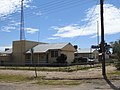
 Church (2021).
 -
 Hospital (2021).
 -
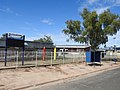 Goodooga Central School, Doyle Street (2021).
 -
 Police station (2021).
 -
 Community hall (2021).
 -
 Telegraph Hotel, Adams Street (2021).
 -
 Hammond Street and housing (2021).
 -
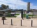 Goodooga Great Artesian Baths area and water tower (2021).
 -
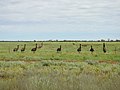 Mob of emus along the Goodooga Brenda Road (2021).
 -
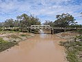
 Bokhara River in flood, from the Goodooga Brenda Road bridge, west of the town (2021).
 -
 Birrie River old bridge, beside the Goodooga Brenda Road (2021).
 -
 Birrie River new bridge, of the Goodooga Brenda Road (2021).
 -
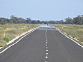 Hebel-Goodooga Road going south, north of the town (2021).
 -
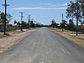
 Langboyd Road, looking north, south-west of the town (2021).
 -
 Jobs Gate Road, looking east, further south-west of the town (2021).


Notes
- ^ a b Australian Bureau of Statistics (27 June 2017). "Goodooga (State Suburb)". 2016 Census QuickStats. Retrieved 6 February 2019.

- ^ Bureau of Meteorology - Accessed 2007-12-17
- ^
 This Wikipedia article incorporates CC-BY-4.0 licensed text from: "Yuwaalayaay". Queensland Aboriginal and Torres Strait Islander languages map. State Library of Queensland. Retrieved 23 January 2020.
 - ^ "Goodooga". Geographical Names Board of New South Wales. Retrieved 22 February 2015.
- ^ Ash et al. 2003: 91
References
- Anna Ash et al., Gamilaraay, Yuwaalaraay and Yuwaalayaay Dictionary. IAD Press: Alice Springs, 2003.
- v
- t
- e


