Cueva de Ágreda
Municipality in Castile and León, Spain

Flag

Seal
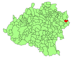
Location of Cueva de Ágreda in Soria Province
41°45′50″N 1°53′14″W / 41.76389°N 1.88722°W / 41.76389; -1.88722
 Spain
Spain Castile and León
 Soria
Soria (2018)[1]
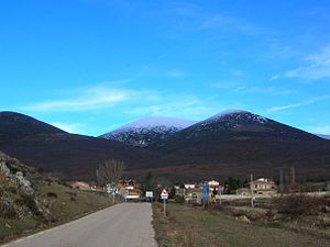
Cueva de Ágreda is a municipality located in the province of Soria, Castile and León, Spain. According to the 2004 census (INE), the municipality has a population of 95 inhabitants.
The nearest main town is Ólvega.
References
- ^ Municipal Register of Spain 2018. National Statistics Institute.
External links
Wikimedia Commons has media related to Cueva de Ágreda.
- Mis Pueblos - Cueva de Agreda
- v
- t
- e
Municipalities in the province of Soria
- Soria
1,000
- Abejar
- Adradas
- Alconaba
- Alcubilla de Avellaneda
- Alcubilla de las Peñas
- Aldealafuente
- Aldealices
- Aldealpozo
- Aldealseñor
- Aldehuela de Periáñez
- Alentisque
- Aliud
- Almajano
- Almaluez
- Almarza
- Almazul
- Almenar de Soria
- Alpanseque
- Arancón
- Arenillas
- Arévalo de la Sierra
- Ausejo de la Sierra
- Baraona
- Barca
- Barcones
- Bayubas de Abajo
- Bayubas de Arriba
- Beratón
- Berlanga de Duero
- Blacos
- Bliecos
- Borjabad
- Borobia
- Buberos
- Buitrago
- Cabrejas del Campo
- Cabrejas del Pinar
- Calatañazor
- Caltojar
- Candilichera
- Carabantes
- Caracena
- Carrascosa de Abajo
- Carrascosa de la Sierra
- Casarejos
- Castilfrío de la Sierra
- Castillejo de Robledo
- Castilruiz
- Cañamaque
- Centenera de Andaluz
- Cerbón
- Cidones
- Cigudosa
- Cihuela
- Ciria
- Cirujales del Río
- Coscurita
- Cubilla
- Cubo de la Solana
- Cueva de Ágreda
- Deza
- Dévanos
- El Royo
- Escobosa de Almazán
- Espeja de San Marcelino
- Espejón
- Estepa de San Juan
- Frechilla de Almazán
- Fresno de Caracena
- Fuentearmegil
- Fuentecambrón
- Fuentecantos
- Fuentelmonge
- Fuentelsaz de Soria
- Fuentepinilla
- Fuentes de Magaña
- Fuentestrún
- Garray
- Golmayo
- Gormaz
- Gómara
- Herrera de Soria
- Hinojosa del Campo
- La Losilla
- La Póveda de Soria
- La Riba de Escalote
- Langa de Duero
- Las Aldehuelas
- Liceras
- Los Rábanos
- Los Villares de Soria
- Magaña
- Maján
- Matalebreras
- Matamala de Almazán
- Medinaceli
- Miño de Medinaceli
- Miño de San Esteban
- Molinos de Duero
- Momblona
- Monteagudo de las Vicarías
- Montejo de Tiermes
- Montenegro de Cameros
- Morón de Almazán
- Muriel Viejo
- Muriel de la Fuente
- Nafría de Ucero
- Narros
- Navaleno
- Nepas
- Nolay
- Noviercas
- Oncala
- Pinilla del Campo
- Portillo de Soria
- Pozalmuro
- Quintana Redonda
- Quintanas de Gormaz
- Quiñonería
- Rebollar
- Recuerda
- Rello
- Renieblas
- Retortillo de Soria
- Reznos
- Rioseco de Soria
- Rollamienta
- Salduero
- San Felices
- San Pedro Manrique
- Santa Cruz de Yanguas
- Santa María de Huerta
- Santa María de las Hoyas
- Serón de Nágima
- Soliedra
- Sotillo del Rincón
- Suellacabras
- Tajahuerce
- Tajueco
- Talveila
- Tardelcuende
- Taroda
- Tejado
- Torlengua
- Torreblacos
- Torrubia de Soria
- Trévago
- Ucero
- Vadillo
- Valdeavellano de Tera
- Valdegeña
- Valdelagua del Cerro
- Valdemaluque
- Valdenebro
- Valdeprado
- Valderrodilla
- Valtajeros
- Velamazán
- Velilla de la Sierra
- Velilla de los Ajos
- Viana de Duero
- Villaciervos
- Villanueva de Gormaz
- Villar del Ala
- Villar del Campo
- Villar del Río
- Villasayas
- Villaseca de Arciel
- Vinuesa
- Vizmanos
- Vozmediano
- Yanguas
- Yelo
 | This article about a location in the province of Soria, Spain is a stub. You can help Wikipedia by expanding it. |
- v
- t
- e


