County of Nares
Map all coordinates using OpenStreetMap
Download coordinates as:
- KML
- GPX (all coordinates)
- GPX (primary coordinates)
- GPX (secondary coordinates)
Cadastral in Queensland, Australia
| Nares Queensland | |||||||||||||||
|---|---|---|---|---|---|---|---|---|---|---|---|---|---|---|---|
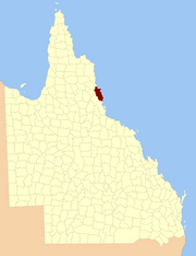 Location within Queensland | |||||||||||||||
| |||||||||||||||
The county of Nares is a cadastral division of Queensland which contains the city of Cairns, Innisfail and most of the Atherton Tableland.[1] The county is divided into civil parishes. It was named after George Nares (1831–1915), a naval officer and commander of HMS Salamander.[2] Cairns is mentioned as being in the county of Nares in the 1911 Britannica.[3] It is bounded by the Daintree River in the north.[4]
Parishes
Nares is subdivided into parishes, listed as follows:
| Parish | LGA | Coordinates | Towns |
|---|---|---|---|
| Barron | Tablelands | 17°15′S 145°29′E / 17.250°S 145.483°E / -17.250; 145.483 (Barron Parish) | Atherton, Tolga |
| Bartle Frere | Tablelands | 17°25′S 145°45′E / 17.417°S 145.750°E / -17.417; 145.750 (Bartle Frere Parish) | |
| Bellenden Ker | Cairns | 17°20′S 145°53′E / 17.333°S 145.883°E / -17.333; 145.883 (Bellenden Ker Parish) | Babinda, Bellenden Ker, Miriwinni |
| Cairns | Cairns | 16°53′S 145°40′E / 16.883°S 145.667°E / -16.883; 145.667 (Cairns Parish) | Cairns, Kuranda |
| Danbulla | Tablelands | 17°07′S 145°36′E / 17.117°S 145.600°E / -17.117; 145.600 (Danbulla Parish) | |
| Dinden | Mareeba | 17°00′S 145°34′E / 17.000°S 145.567°E / -17.000; 145.567 (Dinden Parish) | |
| Dirran | Tablelands | 17°30′S 145°37′E / 17.500°S 145.617°E / -17.500; 145.617 (Dirran Parish) | Tarzali, Millaa Millaa |
| Dulanban | Cairns | 16°40′S 145°33′E / 16.667°S 145.550°E / -16.667; 145.550 (Dulanban Parish) | |
| East Barron | Tablelands | 17°19′S 145°33′E / 17.317°S 145.550°E / -17.317; 145.550 (East Barron Parish) | Yungaburra |
| Formartine | Mareeba | 16°52′S 145°29′E / 16.867°S 145.483°E / -16.867; 145.483 (Formartine Parish) | |
| Gadgarra | Tablelands | 17°15′S 145°44′E / 17.250°S 145.733°E / -17.250; 145.733 (Gadgarra Parish) | |
| Glady | Cassowary Coast | 17°28′S 145°56′E / 17.467°S 145.933°E / -17.467; 145.933 (Glady Parish) | Flying Fish Point |
| Grafton | Cairns | 17°05′S 145°44′E / 17.083°S 145.733°E / -17.083; 145.733 (Grafton Parish) | Edmonton, Gordonvale |
| Hull | Cassowary Coast | 17°47′S 146°00′E / 17.783°S 146.000°E / -17.783; 146.000 (Hull Parish) | Silkwood, South Mission Beach, El Arish |
| Japoon | Cassowary Coast | 17°44′S 145°55′E / 17.733°S 145.917°E / -17.733; 145.917 (Japoon Parish) | Japoon |
| Johnstone | Cassowary Coast | 17°36′S 145°55′E / 17.600°S 145.917°E / -17.600; 145.917 (Johnstone Parish) | Innisfail, South Johnstone |
| Jordan | Cassowary Coast | 17°39′S 145°45′E / 17.650°S 145.750°E / -17.650; 145.750 (Jordan Parish) | |
| Malanda | Tablelands | 17°22′S 145°37′E / 17.367°S 145.617°E / -17.367; 145.617 (Malanda Parish) | Malanda |
| Monamona | Mareeba | 16°46′S 145°30′E / 16.767°S 145.500°E / -16.767; 145.500 (Monamona Parish) | |
| Mourilyan | Cassowary Coast | 17°37′S 146°03′E / 17.617°S 146.050°E / -17.617; 146.050 (Mourilyan Parish) | Mourilyan, parts of Innisfail |
| Palmerston | Cassowary Coast | 17°34′S 145°45′E / 17.567°S 145.750°E / -17.567; 145.750 (Palmerston Parish) | |
| Russell | Cairns | 17°19′S 145°59′E / 17.317°S 145.983°E / -17.317; 145.983 (Russell Parish) | Bramston Beach |
| Smithfield | Tablelands | 16°46′S 145°38′E / 16.767°S 145.633°E / -16.767; 145.633 (Smithfield Parish) | Northern Beaches |
| Sophia | Cairns | 17°07′S 145°52′E / 17.117°S 145.867°E / -17.117; 145.867 (Sophia Parish) | Aloomba |
| Tinaroo | Mareeba | 17°04′S 145°25′E / 17.067°S 145.417°E / -17.067; 145.417 (Tinaroo Parish) | Mareeba, Walkamin |
| Trinity | Cairns | 16°58′S 145°49′E / 16.967°S 145.817°E / -16.967; 145.817 (Trinity Parish) | Yarrabah |
References
- ^ Queensland showing counties / compiled and published at the Survey Department, Brisbane, Brisbane : Survey Dept., 1900.
- ^ "Nares – county (entry 23870)". Queensland Place Names. Queensland Government. Retrieved 21 June 2017.
- ^ Chisholm, Hugh, ed. (1911). "Cairns" . Encyclopædia Britannica. Vol. 4 (11th ed.). Cambridge University Press. p. 953.
- ^ Cook District, County of Nares Maps - P9 Series Archived 2011-07-22 at the Wayback Machine at Queensland Archives.
External links
- [1] "Map of the County of Nares (sheet 1)". Queensland Government. 1919.
- [2] "Map of the County of Nares (sheet 2)". Queensland Government. 1919.
16°55′S 145°47′E / 16.917°S 145.783°E / -16.917; 145.783


