Cherangode
Village in Tamil Nadu, India
Village in Tamil Nadu, India
11°31′53″N 76°19′31″E / 11.53139°N 76.32528°E / 11.53139; 76.32528 India
India (2011)
643205
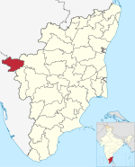
Cherangode is a village located in Tamil Nadu, India. It is located close to Tamil Nadu's western border with Kerala. As of 2011, the village had a population of 33,506.[1]
Geography
Cherangode is located to the west of the Nilgiri Mountains, about 42 kilometres northwest of the district capital Udhagamandalam. The total area of the village is 7494 hectares.[2]
Demographics
According to the 2011 census, the population of Cherangode was 33,506, including 16,475 males and 17,031 females. The working-age population accounted for 45.21% of the total population. The literacy rate stood at 78.65%, with 13,840 of the male residents and 12,511 of the female residents being literate.[1]
References
- ^ a b "Population finder 2011". Office of the Registrar General $ Census Commissioner, India. Retrieved 3 October 2023.
- ^ "Map of Cherangode village in Panthalur tahsil, The Nilgiris, India". Village Map. Retrieved 3 October 2023.
- v
- t
- e
towns
- Achanakal
- Aravenu
- Athigaratty
- Avilanji
- Bandishola
- Bearhatty
- Bellikkal
- Burliar
- Chembakolli
- Cherangode
- Forest Dale
- Halatty Manithalatty
- Hullickal
- Ithalar
- Jandha
- Jegathala
- Ketti
- Kinnakorai
- Koderi
- Kundha Hosahatty
- Kuruthukuli
- Lovedale
- Manihatty
- Mango Orange
- Melur
- Mulligoor
- Sundatty
- Thambatty
- Thangadu
- Thanthanadu
- Theppakadu
- Yedakadu
- Yedapalli
- Yellanahalli
- People


