Chaillu Massif
Mountain range in Gabon
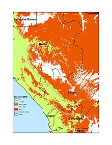
The Chaillu Mountains are a mountain range straddling southern Gabon and the Republic of Congo which is named after the French explorer Paul Du Chaillu, who explored and documented this region in the 19th century.
The highest peaks are Mont Iboundji (980m), and Mt Mimongo (1020 m). The rocks of the range are sedimentary in origin.
The range is home to the rises of several rivers including the Louesse, Ogoulou, Ikoy, Lolo, Lekoko, Lebombi, and Offoue.
References
- Gardinier David. 1994. Historical Dictionary of Gabon 2nd Edition. USA: The Scarercrow Press, Inc
- v
- t
- e
Major African geological formations
- Major plates: African Plate
- Minor plates: Somali Plate
- Microplates: Lwandle Plate
- Madagascar Plate
- Rovuma Plate
- Seychelles Plate
- Victoria Microplate
- Aswa Dislocation
- Broodkop Shear Zone
- Central African Shear Zone
- Chuan Shear Zones
- Foumban Shear Zone
- Kandi Fault Zone
- Mwembeshi Shear Zone
- Todi Shear Zone
- Western Meseta Shear Zone
- Afar Triangle
- Anza trough
- Bahr el Arab rift
- Benue Trough
- Blue Nile rift
- East African Rift
- Gulf of Suez Rift
- Lamu Embayment
- Melut Basin
- Muglad Basin
- Red Sea Rift
- Sangha Aulacogen
- Atbara rift
- Urema Valley
- West and Central African Rift System
- White Nile rift
- Angola Basin
- Aoukar
- Blue Nile Basin
- Chad Basin
- Congo Basin
- Douala Basin
- El Djouf
- Karoo Basin
- Gabon Basin
- Iullemmeden Basin
- Kufra Basin
- Murzuq Basin
- Niger Delta Basin
- Ogaden Basin
- Orange River Basin
- Ouled Abdoun Basin
- Owambo Basin
- Reggane Basin
- Rio del Rey Basin
- Sirte Basin
- Somali Coastal Basin
- Taoudeni Basin
- Tanzania Coastal Basin
- Tindouf Basin
- Turkana Basin
- Aïr Mountains
- Atlas Mountains
- Aurès Mountains
- Bambouk Mountains
- Blue Mountains
- Cameroon line
- Central Pangean Mountains
- Chaillu Mountains
- Drakensberg
- Eastern Arc Mountains
- Eastern Rift mountains
- Ethiopian Highlands
- Great Escarpment
- Great Karas Mountains
- Guinea Highlands
- Hoggar Mountains
- Imatong Mountains
- Jebel Uweinat
- Loma Mountains
- Mandara Mountains
- Marrah Mountains
- Mitumba Mountains
- Nuba Mountains
- Rif Mountains
- Rwenzori Mountains
- Sankwala Mountains
- Serra da Leba
- Serra da Chela
- Teffedest Mountains
- Tibesti Mountains
2°32′0″S 11°10′0″E / 2.53333°S 11.16667°E / -2.53333; 11.16667
 | This Gabon location article is a stub. You can help Wikipedia by expanding it. |
- v
- t
- e


