Budiná
Municipality in Slovakia
48°28′N 19°29′E / 48.467°N 19.483°E / 48.467; 19.483 Slovakia
985 12 (pošta Tuhár)
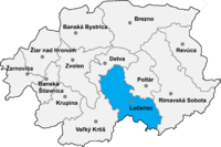
Budiná (Hungarian: Budaszállás) is a village and municipality in the Lučenec District in the Banská Bystrica Region of Slovakia.
History
In historical records, the village was first mentioned in 1393 (1393 Brtolehutaya, 1467 Budalehotha). It belonged to Divín castle. From 1554 to 1595 it suffered Turkish occupation.
External links
 Media related to Budiná at Wikimedia Commons
- https://web.archive.org/web/20071217080336/http://www.statistics.sk/mosmis/eng/run.html
- http://www.e-obce.sk/obec/budina/budina.html
- v
- t
- e
Municipalities of Lučenec District
- Ábelová
- Belina
- Biskupice
- Boľkovce
- Budiná
- Bulhary
- Buzitka
- Čakanovce
- Čamovce
- Divín
- Dobroč
- Fiľakovské Kováče
- Gregorova Vieska
- Halič
- Holiša
- Jelšovec
- Kalonda
- Kotmanová
- Lehôtka
- Lentvora
- Lipovany
- Lovinobaňa
- Lupoč
- Ľuboreč
- Mašková
- Mikušovce
- Mučín
- Mýtna
- Nitra nad Ipľom
- Nové Hony
- Panické Dravce
- Pinciná
- Píla
- Pleš
- Podrečany
- Polichno
- Praha
- Prša
- Radzovce
- Rapovce
- Ratka
- Ružiná
- Stará Halič
- Šiatorská Bukovinka
- Šurice
- Šávoľ
- Šíd
- Tomášovce
- Točnica
- Trebeľovce
- Trenč
- Tuhár
- Veľká nad Ipľom
- Veľké Dravce
- Vidiná

| Authority control databases: National |
|
|---|
 | This Banská Bystrica Region geography article is a stub. You can help Wikipedia by expanding it. |
- v
- t
- e


